
11 TREKKING & BIKE
Trekking e non solo
Per poter orientarvi sui sentieri del nostro Carso (sia a piedi che mountain bike) consigliamo di scaricarsi l'applicazione Mappz.cz, dove sono visibili tutti i percorsi con l'opportunità di tracciare il percorso che effettuate.
In order to orient yourself on the paths of our Karst (both on foot and by mountain bike) we recommend downloading the Mappz.cz application, where all the routes are visible with the opportunity to trace the route you follow.
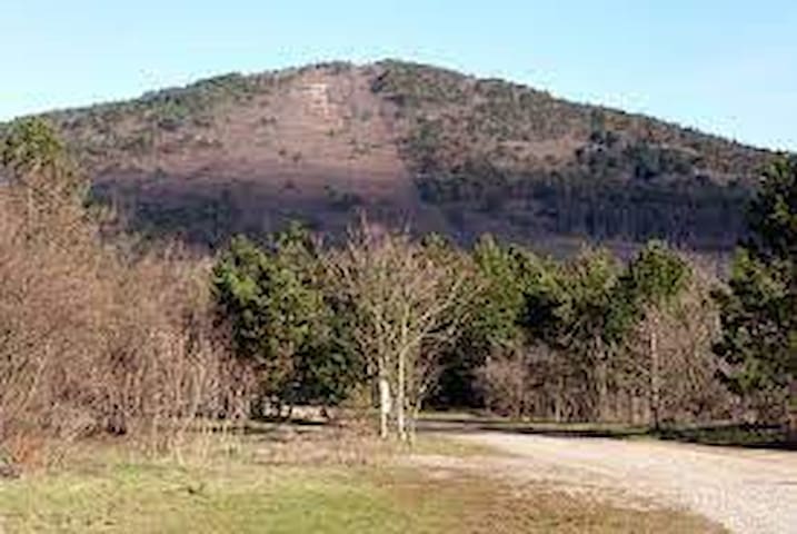
per gli amanti del trekking nella Riserva Naturale Regionale del Monte Lanaro - Volnik. Seguendo le indicazioni del percorso Gemina verso il monte Ojstri vrh di Sgonico raggiungete la vetta del Monte Lanaro - Volnik, da dove si gode un vasto panorama a 360°. Il sentiero più corto parte da Sagrado - Zagradec (soli 2 km da Sgonico - Zgonik) vicino ai due agriturismi Milic e Ostrouska.
Volendo si può proseguire per Repen, passando dallo stagno Močilo, oltre la cava di pietra Petrevica per visitare la Casa carsica - Kraška hiša e poi fino a Zolla - Col per salire sulla Rocca di Monrupino oppure seguire il Sentiero dei poeti.
for trekking lovers in the Regional Nature Reserve of Mount Lanaro - Volnik. Following the indications of the Gemina route towards Mount Ojstri vrh di Sgonico you will reach the summit of Mount Lanaro - Volnik, from where you can enjoy a vast 360 ° panorama. The shortest path starts from Sagrado - Zagradec (only 2 km from Sgonico - Zgonik) near the two farmhouses Milic and Ostrouska.
If you want, you can continue to Repen, passing by the Močilo pond, past the Petrevica stone quarry to visit the Karst House - Kraška hiša and then up to Zolla - Col to climb the Rock of Monrupino or follow the Path of the poets.
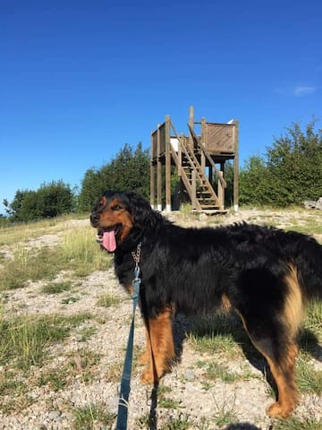
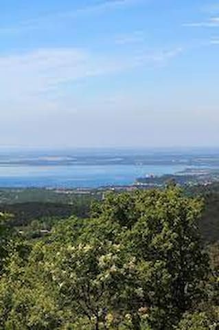
Monte Lanaro/Volnik 544m
per gli amanti del trekking nella Riserva Naturale Regionale del Monte Lanaro - Volnik. Seguendo le indicazioni del percorso Gemina verso il monte Ojstri vrh di Sgonico raggiungete la vetta del Monte Lanaro - Volnik, da dove si gode un vasto panorama a 360°. Il sentiero più corto parte da Sagrado - Zagradec (soli 2 km da Sgonico - Zgonik) vicino ai due agriturismi Milic e Ostrouska.
Volendo si può proseguire per Repen, passando dallo stagno Močilo, oltre la cava di pietra Petrevica per visitare la Casa carsica - Kraška hiša e poi fino a Zolla - Col per salire sulla Rocca di Monrupino oppure seguire il Sentiero dei poeti.
for trekking lovers in the Regional Nature Reserve of Mount Lanaro - Volnik. Following the indications of the Gemina route towards Mount Ojstri vrh di Sgonico you will reach the summit of Mount Lanaro - Volnik, from where you can enjoy a vast 360 ° panorama. The shortest path starts from Sagrado - Zagradec (only 2 km from Sgonico - Zgonik) near the two farmhouses Milic and Ostrouska.
If you want, you can continue to Repen, passing by the Močilo pond, past the Petrevica stone quarry to visit the Karst House - Kraška hiša and then up to Zolla - Col to climb the Rock of Monrupino or follow the Path of the poets.
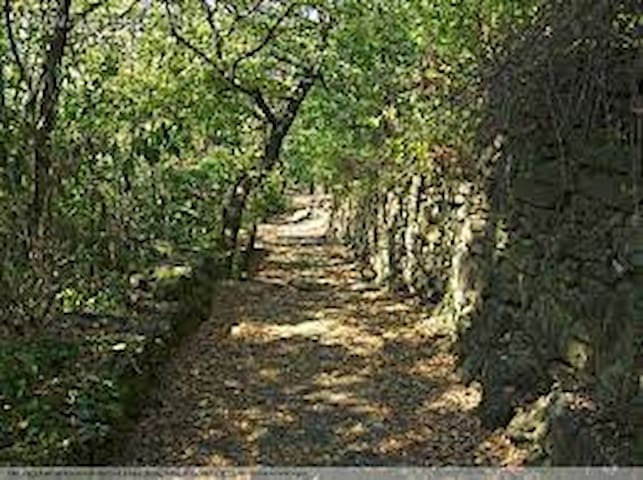
sveti Lenart in sloveno, dista 4 km da Sgonico, seguendo il sentiero Gemina, a Sales - Salež si prosegue verso il monte Coste/Kosten e poi vero il monte San Leonardo - sveti Lenart. Si hanno diverse opzioni della scelta dei itinerari: Samatorza - Samatorca presso il bocciodromo, dove di solito potete rifocilarvi in qualche osmiza aperta oppure Ternova - Trnovca dove trovate la Trattoria gostilna Suban.
I percorsi sono ideali per trekking o parzialmente in mountian-bike. Dalla cima potete godervi un panorama a 360° - Slovenia, Trieste, Grado e Alpi.
sveti Lenart in Slovenian, is 4 km from Sgonico, following the Gemina path, in Sales - Salež continue towards Mount Coste/Kosten and then towards Mount San Leonardo - sveti Lenart. You have different options for choosing the itineraries: Samatorza - Samatorca at the bowling green, where you can usually refresh yourself in some open osmiza or Ternova - Trnovca where you can find the Trattoria gostilna Suban. The routes are ideal for trekking or partially mountain-biking. From the top you can enjoy a 360 ° panorama - Slovenia, Trieste, Grado and the Alps.
Monte San Leonardo
sveti Lenart in sloveno, dista 4 km da Sgonico, seguendo il sentiero Gemina, a Sales - Salež si prosegue verso il monte Coste/Kosten e poi vero il monte San Leonardo - sveti Lenart. Si hanno diverse opzioni della scelta dei itinerari: Samatorza - Samatorca presso il bocciodromo, dove di solito potete rifocilarvi in qualche osmiza aperta oppure Ternova - Trnovca dove trovate la Trattoria gostilna Suban.
I percorsi sono ideali per trekking o parzialmente in mountian-bike. Dalla cima potete godervi un panorama a 360° - Slovenia, Trieste, Grado e Alpi.
sveti Lenart in Slovenian, is 4 km from Sgonico, following the Gemina path, in Sales - Salež continue towards Mount Coste/Kosten and then towards Mount San Leonardo - sveti Lenart. You have different options for choosing the itineraries: Samatorza - Samatorca at the bowling green, where you can usually refresh yourself in some open osmiza or Ternova - Trnovca where you can find the Trattoria gostilna Suban. The routes are ideal for trekking or partially mountain-biking. From the top you can enjoy a 360 ° panorama - Slovenia, Trieste, Grado and the Alps.
da Malchina – Mavhinje attraverso Sgonico – Zgonik fino a Repen il percorso Gemina (che passa proprio davanti alla Casa Olea) unisce diversi sentieri nella natura carsica del altipiano carsico da godersi a piedi, in mountain bike o a cavallo.
L’itinerario si sviluppa sfruttando alcune strade poderali utilizzate un tempo come vie secondarie e di servizio per le attività agricole e pastorali.
I numerosi cartelli con le frecce verdi su fondo giallo posti lungo la via indicano la direzione da percorrere, le osmize, gli agriturismi e le molte attività artigianali che si incontrano lungo il percorso. La segnaletica è arricchita anche da informazioni relative alla flora e alla fauna presenti lungo il tracciato.
Il tracciato è stato così chiamato per omaggiare la strada romana che congiungeva Aquileia a Trieste. “Gemina” deriva con buona probabilità dal nome della XIII Legione, che costruì questo tratto viario, allora necessario a collegare l’impero romano con Lubiana.
from Malchina - Mavhinje through Sgonico - Zgonik to Repen the Gemina route (which passes right in front of Casa Olea) combines several trails in the karst nature of the karst plateau to be enjoyed on foot, by mountain bike or on horseback.
The itinerary develops using some farm roads that were once used as secondary and service roads for agricultural and pastoral activities.
The numerous signs with green arrows on a yellow background placed along the road indicate the direction to go, the osmize, the agritourisms and the many craft activities that are encountered along the way. The signs are also enriched by information relating to the flora and fauna present along the route.
The route was so named to pay homage to the Roman road that connected Aquileia to Trieste. "Gemina" probably derives from the name of the XIII Legion, which built this stretch of road, then necessary to connect the Roman Empire with Ljubljana.
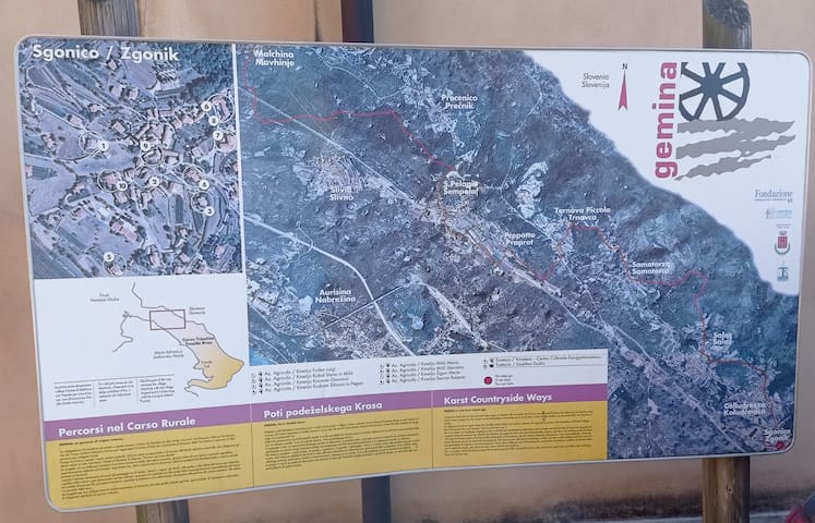
Gemina Percorsi nel Cars Rurale - Poto podeželskega Krasa
da Malchina – Mavhinje attraverso Sgonico – Zgonik fino a Repen il percorso Gemina (che passa proprio davanti alla Casa Olea) unisce diversi sentieri nella natura carsica del altipiano carsico da godersi a piedi, in mountain bike o a cavallo.
L’itinerario si sviluppa sfruttando alcune strade poderali utilizzate un tempo come vie secondarie e di servizio per le attività agricole e pastorali.
I numerosi cartelli con le frecce verdi su fondo giallo posti lungo la via indicano la direzione da percorrere, le osmize, gli agriturismi e le molte attività artigianali che si incontrano lungo il percorso. La segnaletica è arricchita anche da informazioni relative alla flora e alla fauna presenti lungo il tracciato.
Il tracciato è stato così chiamato per omaggiare la strada romana che congiungeva Aquileia a Trieste. “Gemina” deriva con buona probabilità dal nome della XIII Legione, che costruì questo tratto viario, allora necessario a collegare l’impero romano con Lubiana.
from Malchina - Mavhinje through Sgonico - Zgonik to Repen the Gemina route (which passes right in front of Casa Olea) combines several trails in the karst nature of the karst plateau to be enjoyed on foot, by mountain bike or on horseback.
The itinerary develops using some farm roads that were once used as secondary and service roads for agricultural and pastoral activities.
The numerous signs with green arrows on a yellow background placed along the road indicate the direction to go, the osmize, the agritourisms and the many craft activities that are encountered along the way. The signs are also enriched by information relating to the flora and fauna present along the route.
The route was so named to pay homage to the Roman road that connected Aquileia to Trieste. "Gemina" probably derives from the name of the XIII Legion, which built this stretch of road, then necessary to connect the Roman Empire with Ljubljana.
per raggiungere la suggestiva dolina Riselce (e tante altre) si parte davanti al comune di Sgonico -Zgonik:
1a variante originale del percorso - proseguire sulla strada principale verso Prosecco - Prosek, arrivando fino al Giardino botanico - Botanični vrt, dopo averlo superato svoltare nella seconda stradina a sinistra e seguire i segnavia in pietra per raggiungere la dolina di Riselce ammirando la flora carsica. Dopo aver fiancheggiato la roccia ed essere usciti dal sentiero dela dolina raggiungete la Grotta del baratro dei cavalli/Frančinovica proseguite verso sinistra e arrivati sulla strada asfaltata per Sgonico - Zgonik girate a sinistra
2a variante - proseguendo sulla strada principale verso Rupinpiccolo - Repnič si arriva all'oasi ecologica e si gira a destra sul sentiero verso la palestra comunale, poi si prosegue seguendo i segnali in pietra carsica scendendo nella dolina di Riselce fino ad arrivare al Giardino Botanico di Sgonico - Botanični vrt oppure sulla strada verso Rupinpiccolo - Repnič
to reach the suggestive Riselce dolina (and many others) we start in front of the municipality of Sgonico -Zgonik:
1st original variant of the route - continue on the main road towards Prosecco - Prosek, arriving as far as the Botanical Garden - Botanični vrt, after passing it, turn into the second small road on the left and follow the stone signs to reach the Riselce dolina admiring the karst flora. After flanking the rock and exiting the path of the dolina you reach the Cave of the abyss of horses / Frančinovica continue to the left and arrived on the asphalted road to Sgonico - Zgonik turn left
2nd variant - continuing on the main road towards Rupinpiccolo - Repnič you arrive at the ecological oasis and turn right on the path towards the municipal gymnasium, then continue following the karst stone signs descending into the Riselce dolina until you reach the Botanical Garden of Sgonico - Botanični vrt or on the road to Rupinpiccolo - Repnič
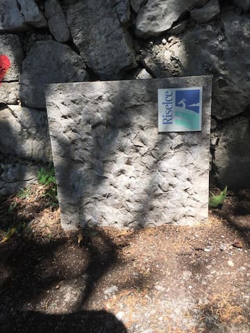
Sentiero Riselce Sgonico - Zgonik
per raggiungere la suggestiva dolina Riselce (e tante altre) si parte davanti al comune di Sgonico -Zgonik:
1a variante originale del percorso - proseguire sulla strada principale verso Prosecco - Prosek, arrivando fino al Giardino botanico - Botanični vrt, dopo averlo superato svoltare nella seconda stradina a sinistra e seguire i segnavia in pietra per raggiungere la dolina di Riselce ammirando la flora carsica. Dopo aver fiancheggiato la roccia ed essere usciti dal sentiero dela dolina raggiungete la Grotta del baratro dei cavalli/Frančinovica proseguite verso sinistra e arrivati sulla strada asfaltata per Sgonico - Zgonik girate a sinistra
2a variante - proseguendo sulla strada principale verso Rupinpiccolo - Repnič si arriva all'oasi ecologica e si gira a destra sul sentiero verso la palestra comunale, poi si prosegue seguendo i segnali in pietra carsica scendendo nella dolina di Riselce fino ad arrivare al Giardino Botanico di Sgonico - Botanični vrt oppure sulla strada verso Rupinpiccolo - Repnič
to reach the suggestive Riselce dolina (and many others) we start in front of the municipality of Sgonico -Zgonik:
1st original variant of the route - continue on the main road towards Prosecco - Prosek, arriving as far as the Botanical Garden - Botanični vrt, after passing it, turn into the second small road on the left and follow the stone signs to reach the Riselce dolina admiring the karst flora. After flanking the rock and exiting the path of the dolina you reach the Cave of the abyss of horses / Frančinovica continue to the left and arrived on the asphalted road to Sgonico - Zgonik turn left
2nd variant - continuing on the main road towards Rupinpiccolo - Repnič you arrive at the ecological oasis and turn right on the path towards the municipal gymnasium, then continue following the karst stone signs descending into the Riselce dolina until you reach the Botanical Garden of Sgonico - Botanični vrt or on the road to Rupinpiccolo - Repnič
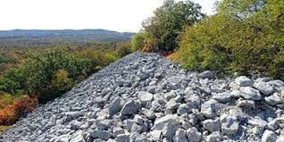
raggiungendo Rupinpiccolo - Repnič a piedi, dopo l’abitato, invece di proseguire per Borgo Grotta Gigante - Briščiki, salite a sinistra sul fianco di una bassa collina, passando tra due cave, il sentiero si trasforma in un tratturo sassoso che costeggia il Monte Lanaro, sboccando infine tra le case di Repen.
Lungo questa strada, dopo circa 100 metri di salita, a sinistra si apre un largo sentiero che porta ad una cava: pochi metri prima della cava si nota l’inizio del muro gigantesco del castelliere. E' il primo castelliere della nostra zona che sia stato portato in luce e ora sia visitabile. Ultimamente sono state scoperte delle antiche mappe stellari scolpire ruditalmente nella pietra carsica rappresentanti il cielo notturno con le stelle.
reaching Rupinpiccolo - Repnič on foot, after the built-up area, instead of continuing to Borgo Grotta Gigante - Briščiki, go up to the left on the side of a low hill, passing between two quarries, the path turns into a stony sheep track that skirts Mount Lanaro , finally opening up between the houses of Repen.
Along this road, after about 100 meters of climbing, a wide path opens on the left that leads to a quarry: a few meters before the quarry you can see the beginning of the gigantic wall of the castelliere. It is the first fortified castle in our area that has been unearthed and can now be visited.
Castelliere di Rupinpiccolo-gradišče Repnič
raggiungendo Rupinpiccolo - Repnič a piedi, dopo l’abitato, invece di proseguire per Borgo Grotta Gigante - Briščiki, salite a sinistra sul fianco di una bassa collina, passando tra due cave, il sentiero si trasforma in un tratturo sassoso che costeggia il Monte Lanaro, sboccando infine tra le case di Repen.
Lungo questa strada, dopo circa 100 metri di salita, a sinistra si apre un largo sentiero che porta ad una cava: pochi metri prima della cava si nota l’inizio del muro gigantesco del castelliere. E' il primo castelliere della nostra zona che sia stato portato in luce e ora sia visitabile. Ultimamente sono state scoperte delle antiche mappe stellari scolpire ruditalmente nella pietra carsica rappresentanti il cielo notturno con le stelle.
reaching Rupinpiccolo - Repnič on foot, after the built-up area, instead of continuing to Borgo Grotta Gigante - Briščiki, go up to the left on the side of a low hill, passing between two quarries, the path turns into a stony sheep track that skirts Mount Lanaro , finally opening up between the houses of Repen.
Along this road, after about 100 meters of climbing, a wide path opens on the left that leads to a quarry: a few meters before the quarry you can see the beginning of the gigantic wall of the castelliere. It is the first fortified castle in our area that has been unearthed and can now be visited.
seguendo il sentiero Gemina (a sinistra da Casa Olea) verso Coludrozza -Koludrovica nel centro del paese proseguite a sinistra per il sentiero fino a raggiungere lo stagno Rekikenca, proseguendo si arriva a Sales-Salež dove in centro paese si può ammirare il pozzo dedicato a Lojze Spacal (noto pittore triestino di origine slovena) oppure si può proseguire sui vari sentieri: vicino alla biblioteca comunale, verso Bristie, vicino alla Osmiza Budin verso il monte Coste/Kosten, San Leonardo-sveti Lenart, Monte Voistri/Ojstri vrh e tanti altri posti.
following the Gemina path (on the left from Casa Olea) towards Coludrozza -Koludrovica in the center of the village, continue on the left along the path until you reach the Rekikenca pond, continuing to reach Sales-Salež where in the center of the village you can admire the well dedicated to Lojze Spacal (well-known Trieste painter of Slovenian origin) or you can continue on the various paths: near the municipal library, towards Bristie, near Osmiza Budin towards Mount Coste / Kosten, San Leonardo-sveti Lenart, Mount Voistri / Ojstri vrh and many other places.
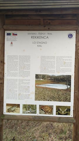
Sentiero Rekikenca - Pešpot Rekikenca
Coludrozza - Koludrovicaseguendo il sentiero Gemina (a sinistra da Casa Olea) verso Coludrozza -Koludrovica nel centro del paese proseguite a sinistra per il sentiero fino a raggiungere lo stagno Rekikenca, proseguendo si arriva a Sales-Salež dove in centro paese si può ammirare il pozzo dedicato a Lojze Spacal (noto pittore triestino di origine slovena) oppure si può proseguire sui vari sentieri: vicino alla biblioteca comunale, verso Bristie, vicino alla Osmiza Budin verso il monte Coste/Kosten, San Leonardo-sveti Lenart, Monte Voistri/Ojstri vrh e tanti altri posti.
following the Gemina path (on the left from Casa Olea) towards Coludrozza -Koludrovica in the center of the village, continue on the left along the path until you reach the Rekikenca pond, continuing to reach Sales-Salež where in the center of the village you can admire the well dedicated to Lojze Spacal (well-known Trieste painter of Slovenian origin) or you can continue on the various paths: near the municipal library, towards Bristie, near Osmiza Budin towards Mount Coste / Kosten, San Leonardo-sveti Lenart, Mount Voistri / Ojstri vrh and many other places.
Kosten in sloveno, seguendo il sentiero Gemina (partendo da Casa Olea a sinistra) verso lo stagno Rekikenca di Coludrozza - Koludrovca, si prosegue verso Sales - Salež, per salire al Monte Coste-Kosten, (si prende il sentiero del CAI n. 45 e poi il sentiero 3), per superare un dislivello di 75 metri. Volendo si prosegue per il monte San Leonardo/sveti Lenart o verso Precenico-Prečnik e Malchina-Mavhinje.
Kosten in Slovenian, following the Gemina path (starting from Casa Olea on the left) towards the Rekikenca pond of Coludrozza - Koludrovca, continue towards Sales - Salež, to climb to Monte Coste-Kosten, (take the CAI path n.45 and then path 3), to overcome a difference in height of 75 meters. If desired, continue to Mount San Leonardo / sveti Lenart or to Precenico-Prečnik and Malchina-Mavhinje.
Monte Coste
Kosten in sloveno, seguendo il sentiero Gemina (partendo da Casa Olea a sinistra) verso lo stagno Rekikenca di Coludrozza - Koludrovca, si prosegue verso Sales - Salež, per salire al Monte Coste-Kosten, (si prende il sentiero del CAI n. 45 e poi il sentiero 3), per superare un dislivello di 75 metri. Volendo si prosegue per il monte San Leonardo/sveti Lenart o verso Precenico-Prečnik e Malchina-Mavhinje.
Kosten in Slovenian, following the Gemina path (starting from Casa Olea on the left) towards the Rekikenca pond of Coludrozza - Koludrovca, continue towards Sales - Salež, to climb to Monte Coste-Kosten, (take the CAI path n.45 and then path 3), to overcome a difference in height of 75 meters. If desired, continue to Mount San Leonardo / sveti Lenart or to Precenico-Prečnik and Malchina-Mavhinje.
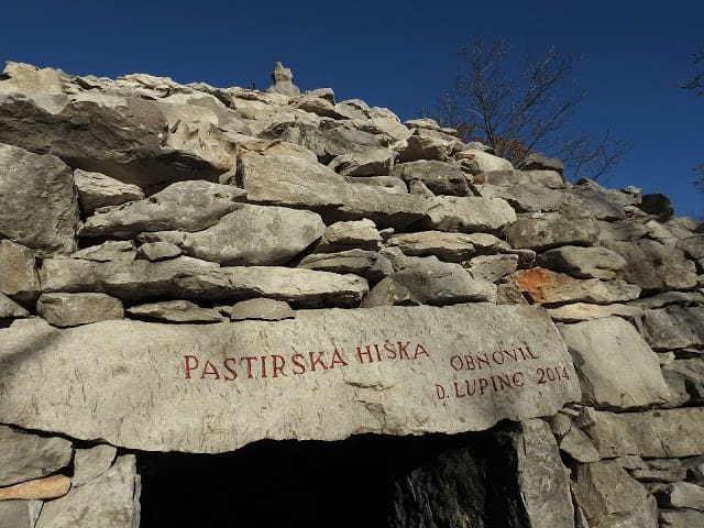
da Prepotto - Praprot (a soli 5 minuti d'auto da Sgonico) oppure seguendo il sentiero Gemina fino a Ternova proseguite per il paese di Prepotto - Praprot o San Pelagio - Šempolaj, dove potete passeggiare sul sentiero di Lupinc Danilo, (realizzato in ricordo dei prigionieri russi che hanno costruito le trincee, ristrutturato nel 2014 in occasione del centenario della Prima Guerra Mondiale) da dove potete ammirare il panorama su tutto il golfo di Trieste. Si possono vedere anche due pastirske hiše, ripari agropastorali costruiti in pietra carsica.
Nelle vicinanze potete visitare la grotta Lesa - jama Grižnica, la grotta Caterina - Katrna jama o la grotta Azzurra - Zidaričeva pejca.
from Prepotto - Praprot (just 5 minutes by car from Sgonico) or following the Gemina path to Ternova continue to the village of Prepotto - Praprot or San Pelagio - Šempolaj, where you can walk on the path of Lupinc Danilo, (created in memory of the Russian prisoners who built the trenches, renovated in 2014 on the occasion of the centenary of the First World War) from where you can admire the view over the entire Gulf of Trieste. You can also see two pastirske hiše, agro-pastoral shelters built in karst stone.
Nearby you can visit the Lesa - jama Grižnica cave, the Catherine cave - Katrna jama or the Blue cave - Zidaričeva pejca.
Parco “Lupinc Škaljunk”
da Prepotto - Praprot (a soli 5 minuti d'auto da Sgonico) oppure seguendo il sentiero Gemina fino a Ternova proseguite per il paese di Prepotto - Praprot o San Pelagio - Šempolaj, dove potete passeggiare sul sentiero di Lupinc Danilo, (realizzato in ricordo dei prigionieri russi che hanno costruito le trincee, ristrutturato nel 2014 in occasione del centenario della Prima Guerra Mondiale) da dove potete ammirare il panorama su tutto il golfo di Trieste. Si possono vedere anche due pastirske hiše, ripari agropastorali costruiti in pietra carsica.
Nelle vicinanze potete visitare la grotta Lesa - jama Grižnica, la grotta Caterina - Katrna jama o la grotta Azzurra - Zidaričeva pejca.
from Prepotto - Praprot (just 5 minutes by car from Sgonico) or following the Gemina path to Ternova continue to the village of Prepotto - Praprot or San Pelagio - Šempolaj, where you can walk on the path of Lupinc Danilo, (created in memory of the Russian prisoners who built the trenches, renovated in 2014 on the occasion of the centenary of the First World War) from where you can admire the view over the entire Gulf of Trieste. You can also see two pastirske hiše, agro-pastoral shelters built in karst stone.
Nearby you can visit the Lesa - jama Grižnica cave, the Catherine cave - Katrna jama or the Blue cave - Zidaričeva pejca.
Gabrovska pečina in sloveno, vicino a Gabrovizza -Gabrovec (vicino al ponte della ferrovia) è possibile raggiungere la grotta che si apre con un'imponente ingresso sul fondo di una dolina alberata e consiste in un'ampia galleria poco inclinata, lunga 175 metri, alcuni tratti del pavimento argilloso sono piuttosto fangosi. Furono fatti vari scavi archeologici che hanno rinvenuto resti murari e vasellame preistorico e romano.
Il nome deriva dai resti di Ursus spelaeus rinvenuti nei depositi di fondo.
Accessibile a tutti purché dotati di una lampada.
Gabrovska pečina in Slovenian, Gabrovizza -Gabrovec (near the railway bridge) it is possible to reach the cave which opens with an imposing entrance at the bottom of a tree-lined dolina and consists of a large slightly inclined tunnel, 175 meters long, some sections of the clayey floor they are quite muddy. Various archaeological excavations were made which found prehistoric and Roman wall remains and pottery.
The name derives from the remains of Ursus spelaeus found in the bottom deposits.
Accessible to all as long as they are equipped with a lamp.
Grotta dell'Orso
Località GabrovizzaGabrovska pečina in sloveno, vicino a Gabrovizza -Gabrovec (vicino al ponte della ferrovia) è possibile raggiungere la grotta che si apre con un'imponente ingresso sul fondo di una dolina alberata e consiste in un'ampia galleria poco inclinata, lunga 175 metri, alcuni tratti del pavimento argilloso sono piuttosto fangosi. Furono fatti vari scavi archeologici che hanno rinvenuto resti murari e vasellame preistorico e romano.
Il nome deriva dai resti di Ursus spelaeus rinvenuti nei depositi di fondo.
Accessibile a tutti purché dotati di una lampada.
Gabrovska pečina in Slovenian, Gabrovizza -Gabrovec (near the railway bridge) it is possible to reach the cave which opens with an imposing entrance at the bottom of a tree-lined dolina and consists of a large slightly inclined tunnel, 175 meters long, some sections of the clayey floor they are quite muddy. Various archaeological excavations were made which found prehistoric and Roman wall remains and pottery.
The name derives from the remains of Ursus spelaeus found in the bottom deposits.
Accessible to all as long as they are equipped with a lamp.
Zidaričeva pejca in sloveno, nelle vicinanze di Prepotto - Praprot e Samatorza - Samatorca c’è un'ampia galleria poco inclinata verso l'interno che si apre sul fianco di un’ampia dolina, è profonda appena 46 metri e ha uno sviluppo planimetrico di circa 225 m. La dolina e la grotta risultano utilizzate fin dalla preistoria, tanto che nei depositi di fondo si sono rinvenuti resti di animali preistorici, di attrezzi e di vasellame preistorici e storici.
Accessibile a tutti, magari portandosi una lampadina.
Nelle vicinanye potete osservare il Castelliere di Samatorza/Gradišče na Leskovcih.
Zidaričeva pejca in Slovenian, in the vicinity of Prepotto - Praprot and Samatorza - Samatorca there is a large gallery slightly inclined towards the interior that opens on the side of a large sinkhole, is just 46 meters deep and has a planimetric development of about 225 m. The sinkhole and the cave have been used since prehistoric times, so much so that the remains of prehistoric animals, tools and prehistoric and historical pottery were found in the bottom deposits.
Accessible to everyone, perhaps bringing a light bulb.
Nearby you can see the Samatorza Castle / Gradišče na Leskovcih.
Grotta Azzurra di Samatorza
SP6Zidaričeva pejca in sloveno, nelle vicinanze di Prepotto - Praprot e Samatorza - Samatorca c’è un'ampia galleria poco inclinata verso l'interno che si apre sul fianco di un’ampia dolina, è profonda appena 46 metri e ha uno sviluppo planimetrico di circa 225 m. La dolina e la grotta risultano utilizzate fin dalla preistoria, tanto che nei depositi di fondo si sono rinvenuti resti di animali preistorici, di attrezzi e di vasellame preistorici e storici.
Accessibile a tutti, magari portandosi una lampadina.
Nelle vicinanye potete osservare il Castelliere di Samatorza/Gradišče na Leskovcih.
Zidaričeva pejca in Slovenian, in the vicinity of Prepotto - Praprot and Samatorza - Samatorca there is a large gallery slightly inclined towards the interior that opens on the side of a large sinkhole, is just 46 meters deep and has a planimetric development of about 225 m. The sinkhole and the cave have been used since prehistoric times, so much so that the remains of prehistoric animals, tools and prehistoric and historical pottery were found in the bottom deposits.
Accessible to everyone, perhaps bringing a light bulb.
Nearby you can see the Samatorza Castle / Gradišče na Leskovcih.
grotta- jama Grižnica nelle vicinanze del parco Lupinc Škaljunk a Prepotto - Praprot.
cave- jama Grižnica near the Lupinc Škaljunk park in Prepotto - Praprot
Grotta Lesa
grotta- jama Grižnica nelle vicinanze del parco Lupinc Škaljunk a Prepotto - Praprot.
cave- jama Grižnica near the Lupinc Škaljunk park in Prepotto - Praprot
pejca v Lazcu in sloveno, a Slivia - Slivno , a soli 10 minuti d'auto potete visitare la grotta profonda 100 metri, molto bella e fresca, si arriva con l'agribus (un trattore con rimorchio) per scendere i 200 gradini.
solo con guida e prenotazione all'agriturismo "Torri di Slivia" (dove si acquista il biglietto).
pejca v Lazcu in Slovenian, in Slivia - Slivno, just 10 minutes by car you can visit the 100 meters deep cave, very beautiful and cool, you can get there with the agribus (a tractor with a trailer) to go down the 200 steps.
only with guide and booking at the "Torri di Slivia" farmhouse (where you buy the ticket).
11 recommandé par les habitants
Cave Towers Slivia
62a Località Aurisina Cavepejca v Lazcu in sloveno, a Slivia - Slivno , a soli 10 minuti d'auto potete visitare la grotta profonda 100 metri, molto bella e fresca, si arriva con l'agribus (un trattore con rimorchio) per scendere i 200 gradini.
solo con guida e prenotazione all'agriturismo "Torri di Slivia" (dove si acquista il biglietto).
pejca v Lazcu in Slovenian, in Slivia - Slivno, just 10 minutes by car you can visit the 100 meters deep cave, very beautiful and cool, you can get there with the agribus (a tractor with a trailer) to go down the 200 steps.
only with guide and booking at the "Torri di Slivia" farmhouse (where you buy the ticket).
a San Giovanni di Timavo - Štivan dopo Sistiana - Sesljan (a 20 minuti d'auto da Sgonico - Zgonik) dopo i lupi sulla parte sinistra possiamo visitare l'antica chiesa e proseguire passeggiando per i sentieri, vicino alle sorgive del splendido fiume Timavo. Nel paese potete acquistare il miele presso l'azienda agricola Farma Jakne.
in San Giovanni di Timavo - Štivan after Sistiana - Sesljan (20 minutes by car from Sgonico - Zgonik) after the wolves on the left side we can visit the ancient church and continue walking along the paths, near the springs of the splendid Timavo river. In the village you can buy honey at the Farma Jakne farm.
Bocche del Timavo
SS14a San Giovanni di Timavo - Štivan dopo Sistiana - Sesljan (a 20 minuti d'auto da Sgonico - Zgonik) dopo i lupi sulla parte sinistra possiamo visitare l'antica chiesa e proseguire passeggiando per i sentieri, vicino alle sorgive del splendido fiume Timavo. Nel paese potete acquistare il miele presso l'azienda agricola Farma Jakne.
in San Giovanni di Timavo - Štivan after Sistiana - Sesljan (20 minutes by car from Sgonico - Zgonik) after the wolves on the left side we can visit the ancient church and continue walking along the paths, near the springs of the splendid Timavo river. In the village you can buy honey at the Farma Jakne farm.
Pešpot Rilke in sloveno , a Sistiana - Sesljan potete godervi una passeggiata panoramica e suggestiva (circa 1,7 km) a picco sul mare, costeggiando la Riserva naturale delle Falesie di Duino fino al castello di Duino. Il sentiero è intitolato a Rainer Maria Rilke (poeta praghese) che trovò ispirazione per le sue Elegie duinesi al tempo in cui visse a Duino, come ospite nel castello dei principi Thurn und Taxis, ai primi del Novecento.
Pešpot Rilke in Slovenian, in Sistiana - Sesljan you can enjoy a scenic and suggestive walk (about 1.7 km) overlooking the sea, skirting the Duino Cliffs Nature Reserve up to Duino Castle. The path is named after Rainer Maria Rilke (Prague poet) who found inspiration for his Duino Elegies at the time he lived in Duino, as a guest in the castle of the Thurn und Taxis princes, in the early twentieth century.
53 recommandé par les habitants
Sentier Rilke
19 Frazione DuinoPešpot Rilke in sloveno , a Sistiana - Sesljan potete godervi una passeggiata panoramica e suggestiva (circa 1,7 km) a picco sul mare, costeggiando la Riserva naturale delle Falesie di Duino fino al castello di Duino. Il sentiero è intitolato a Rainer Maria Rilke (poeta praghese) che trovò ispirazione per le sue Elegie duinesi al tempo in cui visse a Duino, come ospite nel castello dei principi Thurn und Taxis, ai primi del Novecento.
Pešpot Rilke in Slovenian, in Sistiana - Sesljan you can enjoy a scenic and suggestive walk (about 1.7 km) overlooking the sea, skirting the Duino Cliffs Nature Reserve up to Duino Castle. The path is named after Rainer Maria Rilke (Prague poet) who found inspiration for his Duino Elegies at the time he lived in Duino, as a guest in the castle of the Thurn und Taxis princes, in the early twentieth century.
passeggiata non impegnativa che va da Aurisina - Nabrežina (posteggiando nelle vicinanze della palestra comunale Savo Ušaj o della scuola media Igo Gruden) verso S. Croce - Križ (circa 1,8 km), attraversa un ambiento boschivo con la vista sul mare, il profumo della salvia vi accompagnerà lungo tutto il percorso. Il sentiero permette di raggiungere la vedetta Liburnia, un tempo torre piezometrica a servizio della rete idrica della città di Trieste, da dove potete godervi una splendido panorama sia sul Carso interno italiano e sloveno che sul golfo di Trieste fino a Grado. Nei pressi si incontra il sentiero dei pescatori - ribiška pot, che scende fino al mare di Aurisina.
non-binding walk that goes from Aurisina - Nabrežina (parking near the Savo Ušaj municipal gymnasium or the Igo Gruden middle school) towards S. Croce - Križ (about 1.8 km), crosses a wooded environment with a sea view, the scent of sage will accompany you throughout the journey. The path allows you to reach the Liburnia lookout, once a piezometric tower serving the water network of the city of Trieste, from where you can enjoy a splendid view of both the Italian and Slovenian inland Karst and the Gulf of Trieste up to Grado. Nearby is the fishermen's path - ribiška pot, which goes down to the Aurisina sea.
10 recommandé par les habitants
Sentiero Tiziana Weiss (o sentiero della salvia)
Località Aurisina Santa Crocepasseggiata non impegnativa che va da Aurisina - Nabrežina (posteggiando nelle vicinanze della palestra comunale Savo Ušaj o della scuola media Igo Gruden) verso S. Croce - Križ (circa 1,8 km), attraversa un ambiento boschivo con la vista sul mare, il profumo della salvia vi accompagnerà lungo tutto il percorso. Il sentiero permette di raggiungere la vedetta Liburnia, un tempo torre piezometrica a servizio della rete idrica della città di Trieste, da dove potete godervi una splendido panorama sia sul Carso interno italiano e sloveno che sul golfo di Trieste fino a Grado. Nei pressi si incontra il sentiero dei pescatori - ribiška pot, che scende fino al mare di Aurisina.
non-binding walk that goes from Aurisina - Nabrežina (parking near the Savo Ušaj municipal gymnasium or the Igo Gruden middle school) towards S. Croce - Križ (about 1.8 km), crosses a wooded environment with a sea view, the scent of sage will accompany you throughout the journey. The path allows you to reach the Liburnia lookout, once a piezometric tower serving the water network of the city of Trieste, from where you can enjoy a splendid view of both the Italian and Slovenian inland Karst and the Gulf of Trieste up to Grado. Nearby is the fishermen's path - ribiška pot, which goes down to the Aurisina sea.
dal centro storico di Aurisina - Nabrežina potete seguire il percorso che i pescatori percorrevano per raggiungere il mare oppure potete partire dalla palestra comunale Savo Ušaj.
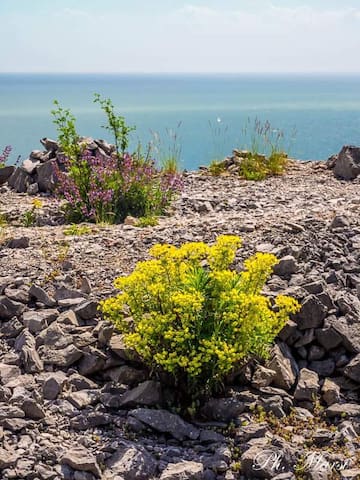
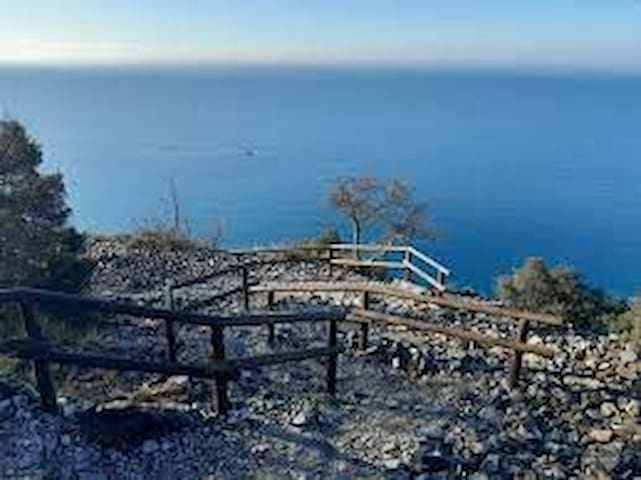
Oltre l’orlo dell’altipiano carsico, il ciglione precipita in mare, raggiungibile 200 metri più in basso, con vertiginosi e panoramicissimi sentieri che costeggiano il crinale e attraversano il versante in cui – lasciato il calcare – affiora un terreno argilloso, impermeabile, rivolto a sud e al riparo della bora (il vento di Trieste).
Attraverso questo itinerario si percorrevano le antiche vie che portavano i pescatori alle Čupe (in sloveno l'antica imbarcazione usata per la pesca) e i contadini ai terrazzi coltivati, con una lunga scalinata fino ai porticcioli di Canovella, quello storico e quello moderno, dove potrete godervi una meritata sosta sulla spiaggia.
from the historic center of Aurisina - Nabrežina you can follow the path that the fishermen followed to reach the sea or you can start from the Savo Ušaj municipal gymnasium.
Beyond the edge of the karst plateau, the ridge plunges into the sea, reachable 200 meters below, with vertiginous and very panoramic paths that flank the ridge and cross the slope where - left the limestone - emerges a clayey, impermeable, facing soil. to the south and sheltered from the bora (the Trieste wind).
Through this itinerary you walked the ancient roads that led fishermen to Čupe (in Slovenian the ancient boat used for fishing) and the farmers to the cultivated terraces, with a long staircase up to the small ports of Canovella, the historic and the modern one, where you can enjoy a well deserved stop on the beach.
Ribiška pot
dal centro storico di Aurisina - Nabrežina potete seguire il percorso che i pescatori percorrevano per raggiungere il mare oppure potete partire dalla palestra comunale Savo Ušaj.
Oltre l’orlo dell’altipiano carsico, il ciglione precipita in mare, raggiungibile 200 metri più in basso, con vertiginosi e panoramicissimi sentieri che costeggiano il crinale e attraversano il versante in cui – lasciato il calcare – affiora un terreno argilloso, impermeabile, rivolto a sud e al riparo della bora (il vento di Trieste).
Attraverso questo itinerario si percorrevano le antiche vie che portavano i pescatori alle Čupe (in sloveno l'antica imbarcazione usata per la pesca) e i contadini ai terrazzi coltivati, con una lunga scalinata fino ai porticcioli di Canovella, quello storico e quello moderno, dove potrete godervi una meritata sosta sulla spiaggia.
from the historic center of Aurisina - Nabrežina you can follow the path that the fishermen followed to reach the sea or you can start from the Savo Ušaj municipal gymnasium.
Beyond the edge of the karst plateau, the ridge plunges into the sea, reachable 200 meters below, with vertiginous and very panoramic paths that flank the ridge and cross the slope where - left the limestone - emerges a clayey, impermeable, facing soil. to the south and sheltered from the bora (the Trieste wind).
Through this itinerary you walked the ancient roads that led fishermen to Čupe (in Slovenian the ancient boat used for fishing) and the farmers to the cultivated terraces, with a long staircase up to the small ports of Canovella, the historic and the modern one, where you can enjoy a well deserved stop on the beach.
Pešpot za Miramar in sloveno, partendo da Contovello - Kontovel (dallo stagno - mlaka) vicino a Prosecco - Prosek (a soli 5 minuti d'auto da Sgonico - Zgonik) potete incamminarvi su un'bellissimo e panoramico sentiero che porta al parco di Miramare, passando per la stazione ferroviaria. E' ombreggiato e facilmente percorribile, un'po impegnativa per la risalita.
Pešpot za Miramar in Slovenian, from Contovello - Kontovel (from the pond - mlaka) near Prosecco - Prosek (just 5 minutes by car from Sgonico - Zgonik) you can walk on a beautiful and panoramic path that leads to the Miramare park, passing through the railway station . It is shaded and easily accessible, a bit challenging for the ascent.
Sentiero Natura
2 Via BeirutPešpot za Miramar in sloveno, partendo da Contovello - Kontovel (dallo stagno - mlaka) vicino a Prosecco - Prosek (a soli 5 minuti d'auto da Sgonico - Zgonik) potete incamminarvi su un'bellissimo e panoramico sentiero che porta al parco di Miramare, passando per la stazione ferroviaria. E' ombreggiato e facilmente percorribile, un'po impegnativa per la risalita.
Pešpot za Miramar in Slovenian, from Contovello - Kontovel (from the pond - mlaka) near Prosecco - Prosek (just 5 minutes by car from Sgonico - Zgonik) you can walk on a beautiful and panoramic path that leads to the Miramare park, passing through the railway station . It is shaded and easily accessible, a bit challenging for the ascent.
(strada Vicentina) oltre alla passeggiata, corsa o giro in mountain bike vi godrete uno splendido panorama sul golfo di Trieste fino a Grado; collega il paese di Prosecco - Prosek con quello di Opicina - Opčine; ottima vedetta per guardare la famosa regata Barcolana che si svolge proprio sotto i vostri occhi nella domenica di ottobre. Ideale anche per gli amanti dell'arrampicata!
(Vicentina road) in addition to walking, running or mountain biking, you will enjoy a splendid view over the Gulf of Trieste up to Grado; connects the town of Prosecco - Prosek with that of Opicina - Opčine; excellent lookout to watch the famous Barcolana regatta which takes place right before your eyes on Sunday in October. Also ideal for climbing lovers!
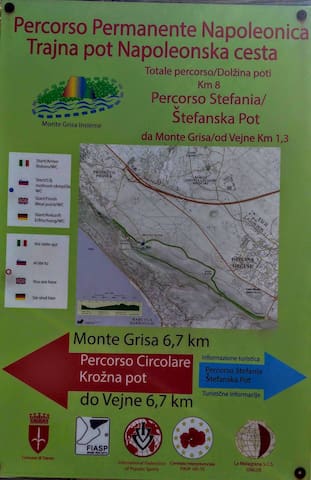
Strada Napoleonica/ Napoleonska Cesta
Strada Napoleonica/ Napoleonska Cesta(strada Vicentina) oltre alla passeggiata, corsa o giro in mountain bike vi godrete uno splendido panorama sul golfo di Trieste fino a Grado; collega il paese di Prosecco - Prosek con quello di Opicina - Opčine; ottima vedetta per guardare la famosa regata Barcolana che si svolge proprio sotto i vostri occhi nella domenica di ottobre. Ideale anche per gli amanti dell'arrampicata!
(Vicentina road) in addition to walking, running or mountain biking, you will enjoy a splendid view over the Gulf of Trieste up to Grado; connects the town of Prosecco - Prosek with that of Opicina - Opčine; excellent lookout to watch the famous Barcolana regatta which takes place right before your eyes on Sunday in October. Also ideal for climbing lovers!
nelle vicinanze della strada Napoleonica, con un ampio posteggio potete passeggiare intorno al santuario per godervi un bellissimo panorama sul golfo di Trieste.
near the Napoleonic road, with a large parking lot you can walk around the sanctuary to enjoy a beautiful view of the Gulf of Trieste
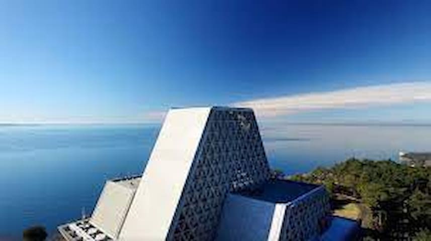
Monte Grisa
nelle vicinanze della strada Napoleonica, con un ampio posteggio potete passeggiare intorno al santuario per godervi un bellissimo panorama sul golfo di Trieste.
near the Napoleonic road, with a large parking lot you can walk around the sanctuary to enjoy a beautiful view of the Gulf of Trieste
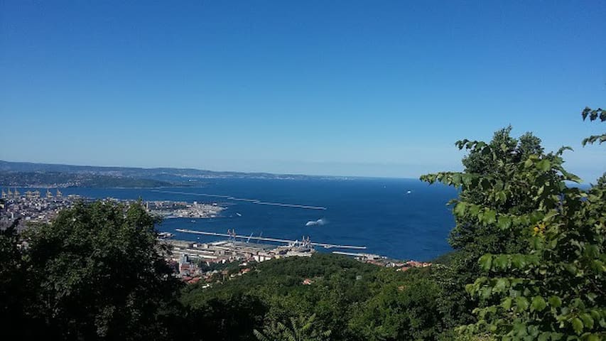
comoda camminata o corsa, che va dall'obelisco di Opicina - Opčine (10 minuti d'auto) a Prosecco - Prosek, dà la possibilità di respirare aria quasi di montagna con vista sul golfo di Trieste,
consigliato il sentiero parallelo che passa per il santuario di monte Grisa e attraversa il bosco in assoluta tranquillità.
comfortable walk or run, which goes from the obelisk of Opicina - Opčine (10 minutes by car) to Prosecco - Prosek, gives the opportunity to breathe almost mountain air with a view of the Gulf of Trieste,
the parallel path that passes through the sanctuary of Monte Grisa and crosses the wood in absolute tranquility is recommended
12 recommandé par les habitants
Obelisco
comoda camminata o corsa, che va dall'obelisco di Opicina - Opčine (10 minuti d'auto) a Prosecco - Prosek, dà la possibilità di respirare aria quasi di montagna con vista sul golfo di Trieste,
consigliato il sentiero parallelo che passa per il santuario di monte Grisa e attraversa il bosco in assoluta tranquillità.
comfortable walk or run, which goes from the obelisk of Opicina - Opčine (10 minutes by car) to Prosecco - Prosek, gives the opportunity to breathe almost mountain air with a view of the Gulf of Trieste,
the parallel path that passes through the sanctuary of Monte Grisa and crosses the wood in absolute tranquility is recommended
per diversi sentieri segnalati nella valle, la principale via d'accesso di fondo valle alla Dolina Glinščice (in sloveno) è dall'abitato di Bagnoli della Rosandra - Boljunec (comune di Dolina) a soli 20 minuti d'auto da Sgonico- Zgonik
La riserva naturale, nel centro della quale scorre l'unico corso d'acqua superficiale del Carso triestino, è una delle mete più amate dagli escursionisti triestini.
E' ideale per le passeggiate, percorsi in bicicletta o arrampicate in mezzo alla natura.
La Val Rosandra - dolina Glinščice è una splendida valle incontaminata che offre un paesaggio naturale noto per la quantità di specie faunistiche e vegetali e per la presenza di rari esemplari animali, caratterizzato inoltre, da fenomeni carsici superficiali e innumerevoli grotte. La valle è divisa in due dal torrente Rosandra - Glinščica che sfocia poi in mare nel Golfo di Trieste. Numerosi sono i siti archeologici, i resti dei castellieri, l’acquedotto romano, i resti del castello medievale a Moccò e poi le tipiche ghiacciaie (jazere) costruite in tempi antichi per custodire il ghiaccio invernale.
for several marked trails in the valley, the main access road to the bottom of the valley to Dolina Glinščice (in Slovenian) is from the town of Bagnoli della Rosandra - Boljunec (municipality of Dolina) just 20 minutes by car from Sgonico-Zgonik
The nature reserve, in the center of which the only surface water course of the Trieste Karst flows, is one of the most popular destinations for triestine hikers.
It is ideal for walking, cycling or climbing in the middle of nature.
Val Rosandra - dolina Glinščice is a splendid unspoiled valley that offers a natural landscape known for the quantity of fauna and flora species and for the presence of rare animal specimens, also characterized by superficial karst phenomena and countless caves. The valley is divided in two by the Rosandra - Glinščica stream which then flows into the sea in the Gulf of Trieste. There are numerous archaeological sites, the remains of the castellieri, the Roman aqueduct, the remains of the medieval castle in Moccò and then the typical iceboxes (jazere) built in ancient times to guard the winter ice.
99 recommandé par les habitants
Réserve naturelle de Val Rosandra
507 Località Bagnoli della Rosandraper diversi sentieri segnalati nella valle, la principale via d'accesso di fondo valle alla Dolina Glinščice (in sloveno) è dall'abitato di Bagnoli della Rosandra - Boljunec (comune di Dolina) a soli 20 minuti d'auto da Sgonico- Zgonik
La riserva naturale, nel centro della quale scorre l'unico corso d'acqua superficiale del Carso triestino, è una delle mete più amate dagli escursionisti triestini.
E' ideale per le passeggiate, percorsi in bicicletta o arrampicate in mezzo alla natura.
La Val Rosandra - dolina Glinščice è una splendida valle incontaminata che offre un paesaggio naturale noto per la quantità di specie faunistiche e vegetali e per la presenza di rari esemplari animali, caratterizzato inoltre, da fenomeni carsici superficiali e innumerevoli grotte. La valle è divisa in due dal torrente Rosandra - Glinščica che sfocia poi in mare nel Golfo di Trieste. Numerosi sono i siti archeologici, i resti dei castellieri, l’acquedotto romano, i resti del castello medievale a Moccò e poi le tipiche ghiacciaie (jazere) costruite in tempi antichi per custodire il ghiaccio invernale.
for several marked trails in the valley, the main access road to the bottom of the valley to Dolina Glinščice (in Slovenian) is from the town of Bagnoli della Rosandra - Boljunec (municipality of Dolina) just 20 minutes by car from Sgonico-Zgonik
The nature reserve, in the center of which the only surface water course of the Trieste Karst flows, is one of the most popular destinations for triestine hikers.
It is ideal for walking, cycling or climbing in the middle of nature.
Val Rosandra - dolina Glinščice is a splendid unspoiled valley that offers a natural landscape known for the quantity of fauna and flora species and for the presence of rare animal specimens, also characterized by superficial karst phenomena and countless caves. The valley is divided in two by the Rosandra - Glinščica stream which then flows into the sea in the Gulf of Trieste. There are numerous archaeological sites, the remains of the castellieri, the Roman aqueduct, the remains of the medieval castle in Moccò and then the typical iceboxes (jazere) built in ancient times to guard the winter ice.
a 15 minuti d'auto potete raggiungere il posteggio vicino all'area di ricerca di Padriciano - Padriče, per godervi un escursione e godervi lo spettacolare panorama su Trieste. Potete anche ammirare diversi animali da fattoria come mucche, asini e maiali. Ci sono diversi sentieri che portano verso Basovizza o verso Conconello.
a 15-minute drive away you can reach the car park near the Padriciano - Padriče research area, to enjoy an excursion and enjoy the spectacular panorama of Trieste. You can also admire various farm animals such as cows, donkeys and pigs. There are several paths that lead to Basovizza or to Conconello
7 recommandé par les habitants
Parco Globojner
a 15 minuti d'auto potete raggiungere il posteggio vicino all'area di ricerca di Padriciano - Padriče, per godervi un escursione e godervi lo spettacolare panorama su Trieste. Potete anche ammirare diversi animali da fattoria come mucche, asini e maiali. Ci sono diversi sentieri che portano verso Basovizza o verso Conconello.
a 15-minute drive away you can reach the car park near the Padriciano - Padriče research area, to enjoy an excursion and enjoy the spectacular panorama of Trieste. You can also admire various farm animals such as cows, donkeys and pigs. There are several paths that lead to Basovizza or to Conconello
a soli 30 minuti d'auto vicino a Basovizza - Bazovica c'è un rilievo montuoso, il più alto del Carso triestino (Kokoš in sloveno - 660 metri), al confine tra Italia e Slovenia ideale per un'escursione sia a piedi che in bicicletta.
Si raggiunge dall'abitato di Basovizza, attraversato il centro del paese seguendo le indicazioni per il valico di Basovizza, appena usciti dal centro abitato, lungo un viale alberato, si apre, sulla destra, uno spiazzo.
just 30 minutes by car near Basovizza - Bazovica there is a mountainous relief, the highest in the Trieste Karst (Kokoš in Slovenian - 660 meters), on the border between Italy and Slovenia ideal for an excursion both on foot and by bike.
It can be reached from the town of Basovizza, crossing the town center following the signs for the Basovizza pass, as soon as you leave the town, along a tree-lined avenue, a clearing opens on the right.
Monte Cocusso
a soli 30 minuti d'auto vicino a Basovizza - Bazovica c'è un rilievo montuoso, il più alto del Carso triestino (Kokoš in sloveno - 660 metri), al confine tra Italia e Slovenia ideale per un'escursione sia a piedi che in bicicletta.
Si raggiunge dall'abitato di Basovizza, attraversato il centro del paese seguendo le indicazioni per il valico di Basovizza, appena usciti dal centro abitato, lungo un viale alberato, si apre, sulla destra, uno spiazzo.
just 30 minutes by car near Basovizza - Bazovica there is a mountainous relief, the highest in the Trieste Karst (Kokoš in Slovenian - 660 meters), on the border between Italy and Slovenia ideal for an excursion both on foot and by bike.
It can be reached from the town of Basovizza, crossing the town center following the signs for the Basovizza pass, as soon as you leave the town, along a tree-lined avenue, a clearing opens on the right.
Pot pesnikov in sloveno, si raggiunge a soli 5 minuti d'auto da Sgonico - Zgonik raggiungendo il paese Col dopo il paese Repen (oppure seguendo le indicazioni del percorso Gemina da Sgonico). Si lascia l'automobile presso il parcheggio del cimitero di Col e si prosegue lungo la strada asfaltata in direzione Col (la Rocca alla vostra destra). Giunti in centro del paese, si svolta a destra in discesa sulla strada asfaltata. Qui comincia il Sentiero dei poeti. Arrivati alla fine, si svolta a destra, e si prosegue fino a raggiungere la cappella votiva. Da qui il percorso si ricongiunge con il Sentiero/Pot Tabor.
Il sentiero è dedicato ai poeti Srečko Kosovel, Umberto Saba e Igo Gruden, i quali hanno maggiormente rappresentato il territorio carsico nelle loro poesie. La passeggiata si snoda su una strada asfaltata chiusa al traffico veicolare lunga circa 500 metri, immersa nel verde e nell'ombra delle querce.
Pot pesnikov in Slovenian, can be reached just 5 minutes by car from Sgonico - Zgonik reaching the village Col after the village Repen (or following the directions for the Gemina da Sgonico route). Leave the car at the parking lot of the Col cemetery and continue along the asphalted road towards Col (the Rocca on your right). Once in the town center, turn right downhill on the asphalted road. Here begins the Path of the Poets. At the end, turn right, and continue until you reach the votive chapel. From here the path rejoins the Path / Pot Tabor.
The trail is dedicated to the poets Srečko Kosovel, Umberto Saba and Igo Gruden, who most represented the karst territory in their poems. The walk winds along an asphalted road closed to vehicular traffic about 500 meters long, surrounded by greenery and in the shade of oak trees.
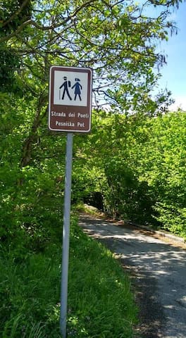
Sentiero dei poeti
Pot pesnikov in sloveno, si raggiunge a soli 5 minuti d'auto da Sgonico - Zgonik raggiungendo il paese Col dopo il paese Repen (oppure seguendo le indicazioni del percorso Gemina da Sgonico). Si lascia l'automobile presso il parcheggio del cimitero di Col e si prosegue lungo la strada asfaltata in direzione Col (la Rocca alla vostra destra). Giunti in centro del paese, si svolta a destra in discesa sulla strada asfaltata. Qui comincia il Sentiero dei poeti. Arrivati alla fine, si svolta a destra, e si prosegue fino a raggiungere la cappella votiva. Da qui il percorso si ricongiunge con il Sentiero/Pot Tabor.
Il sentiero è dedicato ai poeti Srečko Kosovel, Umberto Saba e Igo Gruden, i quali hanno maggiormente rappresentato il territorio carsico nelle loro poesie. La passeggiata si snoda su una strada asfaltata chiusa al traffico veicolare lunga circa 500 metri, immersa nel verde e nell'ombra delle querce.
Pot pesnikov in Slovenian, can be reached just 5 minutes by car from Sgonico - Zgonik reaching the village Col after the village Repen (or following the directions for the Gemina da Sgonico route). Leave the car at the parking lot of the Col cemetery and continue along the asphalted road towards Col (the Rocca on your right). Once in the town center, turn right downhill on the asphalted road. Here begins the Path of the Poets. At the end, turn right, and continue until you reach the votive chapel. From here the path rejoins the Path / Pot Tabor.
The trail is dedicated to the poets Srečko Kosovel, Umberto Saba and Igo Gruden, who most represented the karst territory in their poems. The walk winds along an asphalted road closed to vehicular traffic about 500 meters long, surrounded by greenery and in the shade of oak trees.
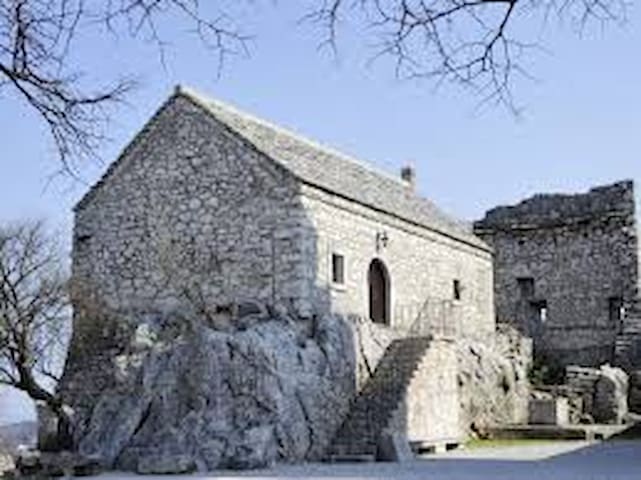
con il sentiero/pešpot Tabor, a soli 10 minuti d'auto raggiungete Repen - Monrupino, dove in una natura ancora intatta e incontaminata si potrà godere della tranquillità e del silenzio. Durante le passeggiate si potrà ammirare, oltre le bellezze architettoniche e storiche come la Casa Carsica a Repen e la Rocca di Monrupino, le peculiarità del territorio come ad esempio gli stagni, le cave, le grotte, le doline, le formazioni calcaree, la tipica boscaglia carsica e la landa carsica. Non sarà di rado incontrare anche qualche animale selvatico come il capriolo.
Il sentiero Tabor - Lasciata l’automobile presso il parcheggio del cimitero di Col, si prosegue lungo la strada asfaltata fino ad arrivare ai famosi Torrioni di Monrupino. Si prosegue in discesa fino ad un incrocio: le indicazioni fanno proseguire a sinistra in salita. Poco dopo, ancora a sinistra lasciando sulla destra una cappella votiva, inizia l’erta in pavè che porta al Santuario di Monrupino. Dalla rocca si gode uno splendido panorama, anche del territorio della vicina Slovenia. Dal Santuario si scende con una ripida stradina nell’abitato di Col; alla fine della strada, dopo aver svoltato a sinistra, si ritorna al punto di partenza.
with the path / pešpot Tabor, just 10 minutes by car you reach Repen - Monrupino, where you can enjoy tranquility and silence in a still intact and uncontaminated nature. During the walks you will be able to admire, in addition to the architectural and historical beauties such as the Casa Carsica in Repen and the Rocca di Monrupino, the peculiarities of the territory such as the ponds, the quarries, the caves, the sinkholes, the limestone formations, the typical karst scrub and the karst moor. It will not be rare to meet some wild animals such as roe deer.
The Tabor path - Leave the car at the parking lot of the Col cemetery, continue along the paved road until you reach the famous Torrioni di Monrupino. Continue downhill until you reach an intersection: the signs lead you to continue uphill to the left. Shortly after, still to the left, leaving a votive chapel on the right, the cobblestone slope begins, leading to the Sanctuary of Monrupino. From the fortress you can enjoy a splendid panorama, even of the territory of neighboring Slovenia. From the Sanctuary you go down a steep road into the town of Col; at the end of the road, after turning left, you return to the starting point.
Monrupino
con il sentiero/pešpot Tabor, a soli 10 minuti d'auto raggiungete Repen - Monrupino, dove in una natura ancora intatta e incontaminata si potrà godere della tranquillità e del silenzio. Durante le passeggiate si potrà ammirare, oltre le bellezze architettoniche e storiche come la Casa Carsica a Repen e la Rocca di Monrupino, le peculiarità del territorio come ad esempio gli stagni, le cave, le grotte, le doline, le formazioni calcaree, la tipica boscaglia carsica e la landa carsica. Non sarà di rado incontrare anche qualche animale selvatico come il capriolo.
Il sentiero Tabor - Lasciata l’automobile presso il parcheggio del cimitero di Col, si prosegue lungo la strada asfaltata fino ad arrivare ai famosi Torrioni di Monrupino. Si prosegue in discesa fino ad un incrocio: le indicazioni fanno proseguire a sinistra in salita. Poco dopo, ancora a sinistra lasciando sulla destra una cappella votiva, inizia l’erta in pavè che porta al Santuario di Monrupino. Dalla rocca si gode uno splendido panorama, anche del territorio della vicina Slovenia. Dal Santuario si scende con una ripida stradina nell’abitato di Col; alla fine della strada, dopo aver svoltato a sinistra, si ritorna al punto di partenza.
with the path / pešpot Tabor, just 10 minutes by car you reach Repen - Monrupino, where you can enjoy tranquility and silence in a still intact and uncontaminated nature. During the walks you will be able to admire, in addition to the architectural and historical beauties such as the Casa Carsica in Repen and the Rocca di Monrupino, the peculiarities of the territory such as the ponds, the quarries, the caves, the sinkholes, the limestone formations, the typical karst scrub and the karst moor. It will not be rare to meet some wild animals such as roe deer.
The Tabor path - Leave the car at the parking lot of the Col cemetery, continue along the paved road until you reach the famous Torrioni di Monrupino. Continue downhill until you reach an intersection: the signs lead you to continue uphill to the left. Shortly after, still to the left, leaving a votive chapel on the right, the cobblestone slope begins, leading to the Sanctuary of Monrupino. From the fortress you can enjoy a splendid panorama, even of the territory of neighboring Slovenia. From the Sanctuary you go down a steep road into the town of Col; at the end of the road, after turning left, you return to the starting point.
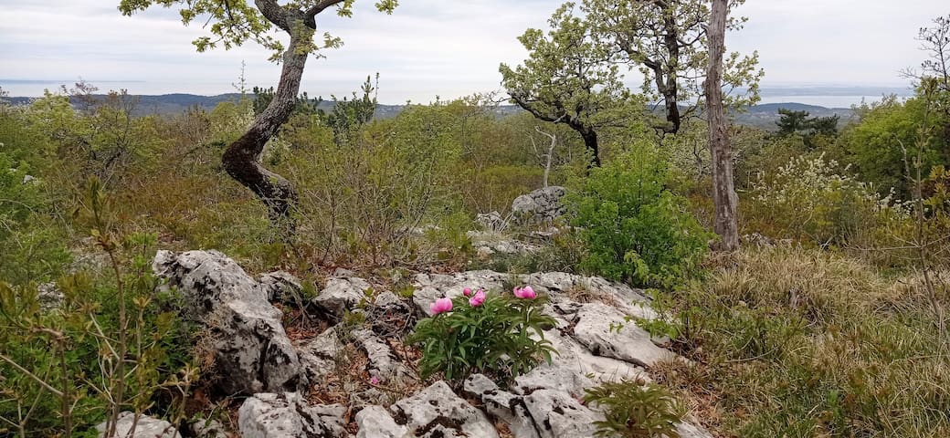
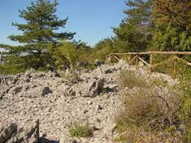
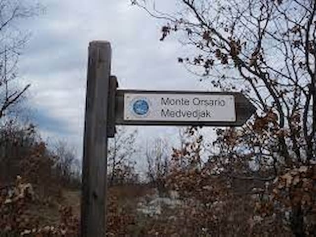
a soli 10 minuti d'auto nel comune di Repen trovate la Riserva Naturale Regionale del Monte Orsario (Medvedjak in sloveno - medved=orso) nell'area è possibile osservare numerose doline, conche circolari causate dall'erosione dell'acqua; ma sono presenti anche molti campi solcati, rocce calcaree affioranti con scannellature, fori e vaschette di corrosione modellate dagli agenti atmosferici. Si tratta dei famosi fenomeni tipici del carsismo superficiale.
Il nome ricorda la presenza dell’orso in queste zone, in epoche ancora recenti.
Presso la prima tabella indicatrice parte un sentierino che dopo pochi passi arriva ad uno stagno artificiale ricavato da un piccolo campo solcato. Il sentiero principale prosegue attraversando la boscaglia e in seguito la landa carsica parzialmente incespugliata. Prima di arrivare alla cima del si attraversa una matura pineta a pino nero e poi ancora un bosco misto con alcuni campi solcati. In vetta, presso i ruderi delle caserme della fine degli anni ’30, si trova una torretta in legno. Da qui la vista spazia a 360°, sia verso il mare che verso la vicina Slovenia.
just 10 minutes by car in the municipality of Repen you will find the Regional Nature Reserve of Mount Orsario (Medvedjak in Slovenian - medved = bear) in the area it is possible to observe numerous sinkholes, circular basins caused by water erosion; but there are also many furrowed fields, limestone rocks outcropping with grooves, holes and corrosion pans shaped by atmospheric agents. These are the famous typical phenomena of superficial karst.
The name recalls the presence of the bear in these areas, in recent times.
At the first indicator table a path starts which after a few steps arrives at an artificial pond obtained from a small furrowed field. The main path continues through the bush and then through the karst land that has been partially set off. Before reaching the top of the mountain, you cross a mature black pine forest and then again a mixed forest with some furrowed fields. At the top, near the ruins of the barracks from the late 1930s, there is a wooden tower. From here the view extends to 360 °, both towards the sea and towards neighboring Slovenia.
Monte Orsario
a soli 10 minuti d'auto nel comune di Repen trovate la Riserva Naturale Regionale del Monte Orsario (Medvedjak in sloveno - medved=orso) nell'area è possibile osservare numerose doline, conche circolari causate dall'erosione dell'acqua; ma sono presenti anche molti campi solcati, rocce calcaree affioranti con scannellature, fori e vaschette di corrosione modellate dagli agenti atmosferici. Si tratta dei famosi fenomeni tipici del carsismo superficiale.
Il nome ricorda la presenza dell’orso in queste zone, in epoche ancora recenti.
Presso la prima tabella indicatrice parte un sentierino che dopo pochi passi arriva ad uno stagno artificiale ricavato da un piccolo campo solcato. Il sentiero principale prosegue attraversando la boscaglia e in seguito la landa carsica parzialmente incespugliata. Prima di arrivare alla cima del si attraversa una matura pineta a pino nero e poi ancora un bosco misto con alcuni campi solcati. In vetta, presso i ruderi delle caserme della fine degli anni ’30, si trova una torretta in legno. Da qui la vista spazia a 360°, sia verso il mare che verso la vicina Slovenia.
just 10 minutes by car in the municipality of Repen you will find the Regional Nature Reserve of Mount Orsario (Medvedjak in Slovenian - medved = bear) in the area it is possible to observe numerous sinkholes, circular basins caused by water erosion; but there are also many furrowed fields, limestone rocks outcropping with grooves, holes and corrosion pans shaped by atmospheric agents. These are the famous typical phenomena of superficial karst.
The name recalls the presence of the bear in these areas, in recent times.
At the first indicator table a path starts which after a few steps arrives at an artificial pond obtained from a small furrowed field. The main path continues through the bush and then through the karst land that has been partially set off. Before reaching the top of the mountain, you cross a mature black pine forest and then again a mixed forest with some furrowed fields. At the top, near the ruins of the barracks from the late 1930s, there is a wooden tower. From here the view extends to 360 °, both towards the sea and towards neighboring Slovenia.
a 15 minuti d'auto da Sgonico - Zgonik, raggiungete il paese Ceroglie - Cerovlje vicino alla chiesa oppure da Adventure Park Trieste, da dove proseguite per l'escursione sul monte Ermada/Grmada - itinerario della Grande guerra e panorami mozzafiato con diverse grotte (consigliabile la visita con uno speleologo) - alcuna è aperta durante la marcia internazionale enogastronomica, storica e didattica (si svolge a maggio).
15 minutes by car from Sgonico - Zgonik, reach the village Ceroglie - Cerovlje near the church or from Adventure Park Trieste, from where you continue for the excursion to Mount Ermada / Grmada - itinerary of the Great War and breathtaking views with several caves ( a visit with a speleologist is recommended) - some are open during the international food and wine, historical and educational march (takes place in May)
Monte Ermada
a 15 minuti d'auto da Sgonico - Zgonik, raggiungete il paese Ceroglie - Cerovlje vicino alla chiesa oppure da Adventure Park Trieste, da dove proseguite per l'escursione sul monte Ermada/Grmada - itinerario della Grande guerra e panorami mozzafiato con diverse grotte (consigliabile la visita con uno speleologo) - alcuna è aperta durante la marcia internazionale enogastronomica, storica e didattica (si svolge a maggio).
15 minutes by car from Sgonico - Zgonik, reach the village Ceroglie - Cerovlje near the church or from Adventure Park Trieste, from where you continue for the excursion to Mount Ermada / Grmada - itinerary of the Great War and breathtaking views with several caves ( a visit with a speleologist is recommended) - some are open during the international food and wine, historical and educational march (takes place in May)
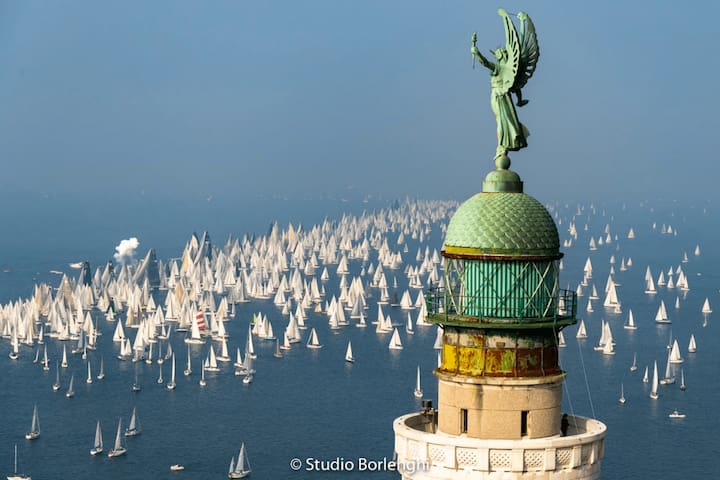
la più grande manifestazione velistica del mondo, con più partecipanti in assoluto, si svolge nella prima metà di ottobre (di solito la seconda domenica).
the largest sailing event in the world, with the most participants ever, takes place in the first half of October (usually on the second Sunday)
6 recommandé par les habitants
Barcola station
la più grande manifestazione velistica del mondo, con più partecipanti in assoluto, si svolge nella prima metà di ottobre (di solito la seconda domenica).
the largest sailing event in the world, with the most participants ever, takes place in the first half of October (usually on the second Sunday)
Non lontano
a sole 2 ore d'auto da Sgonico - Zgonik, potete rinfrescarvi sulla montagna delle Alpi Giulie, che si trova nel comune di Tarvisio, dove in inverno si scia.
Il santuario e il rifugio, che si trovano in cima, sono raggiungibili a piedi, attraverso il suggestivo Sentiero del Pellegrino che si snoda tra i boschi della foresta di Tarvisio, oppure con la telecabina che parte da Camporosso.
just 2 hours by car from Sgonico - Zgonik, you can cool off on the mountain of the Julian Alps, located in the municipality of Tarvisio, where you can ski in winter.
The sanctuary and the refuge, which are located at the top, can be reached on foot, through the suggestive Pellegrino Path that winds through the woods of the Tarvisio forest, or by taking the cable car that starts from Camporosso.
15 recommandé par les habitants
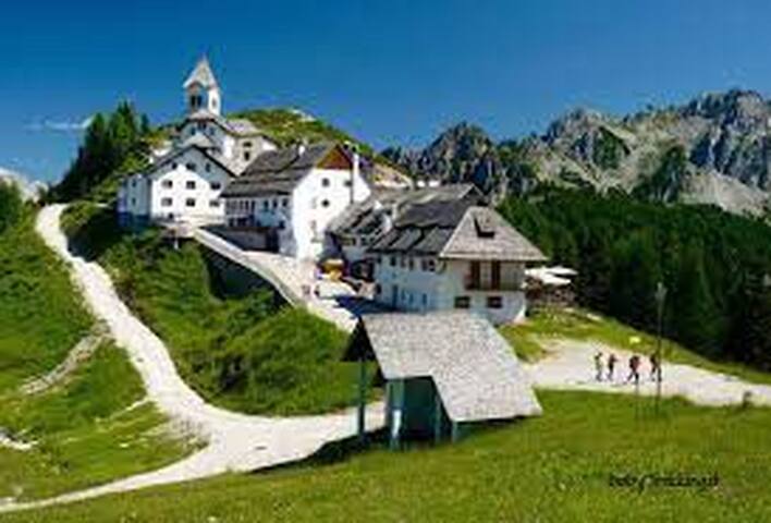
Monte Santo di Lussari
a sole 2 ore d'auto da Sgonico - Zgonik, potete rinfrescarvi sulla montagna delle Alpi Giulie, che si trova nel comune di Tarvisio, dove in inverno si scia.
Il santuario e il rifugio, che si trovano in cima, sono raggiungibili a piedi, attraverso il suggestivo Sentiero del Pellegrino che si snoda tra i boschi della foresta di Tarvisio, oppure con la telecabina che parte da Camporosso.
just 2 hours by car from Sgonico - Zgonik, you can cool off on the mountain of the Julian Alps, located in the municipality of Tarvisio, where you can ski in winter.
The sanctuary and the refuge, which are located at the top, can be reached on foot, through the suggestive Pellegrino Path that winds through the woods of the Tarvisio forest, or by taking the cable car that starts from Camporosso.
a pochi chilometri da Gorizia, un suggestivo itinerario tra storia e natura. Grazie ad una serie di percorsi facili e adatti a tutti, si possono scoprire diverse strutture e i monumenti costruiti sulle pendici e sulle quattro cime di questo rilievo carsico risalenti alla Grande Guerra.
a few kilometers from Gorizia, an evocative itinerary between history and nature. Thanks to a series of easy routes suitable for everyone, you can discover different structures and monuments built on the slopes and on the four peaks of this karst relief dating back to the Great War.
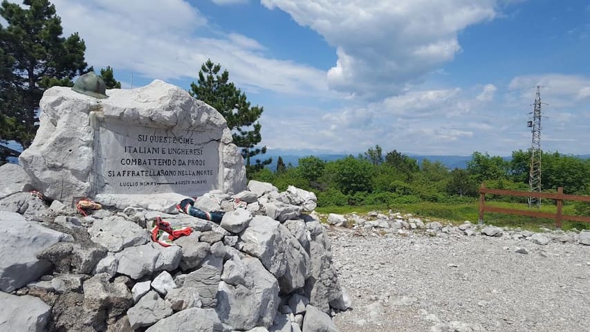
Monte San Michele
a pochi chilometri da Gorizia, un suggestivo itinerario tra storia e natura. Grazie ad una serie di percorsi facili e adatti a tutti, si possono scoprire diverse strutture e i monumenti costruiti sulle pendici e sulle quattro cime di questo rilievo carsico risalenti alla Grande Guerra.
a few kilometers from Gorizia, an evocative itinerary between history and nature. Thanks to a series of easy routes suitable for everyone, you can discover different structures and monuments built on the slopes and on the four peaks of this karst relief dating back to the Great War.
a 30 minuti d'auto potete raggiungere Doberdò del lago - Doberdob
La Riserva Naturale Regionale Laghi di Doberdò e Pietrarossa, istituita nel 1996, è un'area protetta friulana adagiata sul Carso goriziano in un territorio che si estende a cavallo dei comuni di Doberdò del Lago - Doberdob, Monfalcone e Ronchi dei Legionari.
Ciò che rende unica questa zona della regione è la presenza di due grandi depressioni carsiche occupate da due laghi separati da rilievi calcarei. La presenza di zone umide, praticamente assenti su tutto il Carso, ha consentito lo sviluppo di ambienti naturali rarissimi in questa area del Paese che è un piacere scoprire passeggiando lungo i sentieri si snodano sul territorio, attraverso habitat tipici degli ambienti aridi, come prati di landa e campi solcati, e delle zone umide che circondano i laghi.
I 4 trekking più affascinanti:
IL PERCORSO DELLA RISERVA
Occorrono circa 4 ore per completare questo itinerario impegnativo. Lungo il percorso si avrà l'opportunità di ammirare siti di interesse storico e naturalistico, come Casa Cadorna, e il cunicolo della prima guerra mondiale, attraverso il quale si raggiunge un magnifico punto panoramico che si affaccia sul lago. Tra folti pioppi, fresche acque argentee, lande cespugliate tipiche delle zone ripariali, e ripide pareti di roccia attrezzate per l'arrampicata, la passeggiata si rivela un'esperienza piacevole che permette di ottenere una visione a 360° dell'area protetta.
PERCORSO AD ANELLO BREVE
E' adatto a tutti il semplice itinerario che, in soli 30 minuti di cammino, permette di osservare le zone più interessanti della riserva. Si parte dal centro visite per poi proseguire verso la vecchia cava Solvay. Con lo sguardo si raggiunge facilmente la laguna di Grado e ci si può soffermare ad ammirare il punto di contatto tra il Carso e la pianura. Passeggiando nella fitta boscaglia, dapprima tra cespugli, pietrai e arbusti e poi tra carpini neri e ornielli, si gode dell'opportunità di scoprire una delle zone più rigogliose e affascinanti della riserva naturale.
PERCORSO AD ANELLO LUNGO
Ripercorrendo alcune delle tappe del Percorso della Riserva, quello ad Anello Lungo permette di visitare in un'ora e mezza alcuni dei siti più interessanti dell'area protetta, come la zona sorgentizia che emerge tra il folto dei pioppi, la cima del Colle Nero, raggiungibile attraverso una scalinata munita di corda di acciaio, l'antico castelliere, in cui si può anche entrare, e le baracche militari del primo conflitto mondiale disseminate lungo il sentiero.
PERCORSO FINO AL LAGO DI DOBERDO'
La passeggiata fino al lago è una sorta di versione ridotta del Percorso della Riserva, oltrepassata la cava di Solvay, il Colle Nero, Casa Cadorna e le pareti per l'arrampicata ed una volta raggiunta la zona sorgentizia e il sentiero che, in discesa, conduce al pontile panoramico, lo sguardo è immediatamente rapito dalla magnifica flora lacustre. Guardando con attenzione e, con un poco di fortuna, si potranno scorgere anche le graziose oche e le anatre in volo che popolano il bacino.
30 minutes by car you can reach Doberdò del lago - Doberdob
The Doberdò and Pietrarossa Lakes Regional Nature Reserve, established in 1996, is a Friuli protected area lying on the Gorizia Karst in a territory that straddles the municipalities of Doberdò del Lago - Doberdob, Monfalcone and Ronchi dei Legionari.
What makes this area of the region unique is the presence of two large karst depressions occupied by two lakes separated by limestone reliefs. The presence of wetlands, practically absent throughout the Karst, has allowed the development of very rare natural environments in this area of the country that is a pleasure to discover by walking along the paths that wind through the territory, through habitats typical of arid environments, such as meadows of moorland and furrowed fields, and the wetlands surrounding the lakes.
The 4 most fascinating treks:
THE PATH OF THE RESERVE
It takes about 4 hours to complete this challenging itinerary. Along the way you will have the opportunity to admire sites of historical and naturalistic interest, such as Casa Cadorna, and the tunnel of the First World War, through which you reach a magnificent panoramic point overlooking the lake. Among thick poplars, cool silvery waters, bushy moors typical of riparian areas, and steep rock walls equipped for climbing, the walk turns out to be a pleasant experience that allows you to get a 360 ° view of the protected area.
SHORT CIRCLE ROUTE
The simple itinerary is suitable for everyone which, in just 30 minutes of walking, allows you to observe the most interesting areas of the reserve. It starts from the visitor center and then continues towards the old Solvay quarry. With a glance you can easily reach the Grado lagoon and you can stop and admire the point of contact between the Karst and the plain. Walking through the dense bush, first among bushes, stone masons and shrubs and then among black hornbeams and ash trees, you will enjoy the opportunity to discover one of the most luxuriant and fascinating areas of the nature reserve.
LONG RING ROUTE
Retracing some of the stages of the Reserve Route, the Long Ring allows you to visit in an hour and a half some of the most interesting sites in the protected area, such as the spring area that emerges from the thicket of poplars, the top of Colle Nero, reachable via a staircase fitted with a steel rope, the ancient castle, which can also be entered, and the military barracks of the First World War scattered along the path.
ROUTE UNTIL LAKE DOBERDO '
The walk to the lake is a sort of shortened version of the Reserve Route, past the Solvay quarry, the Colle Nero, Casa Cadorna and the climbing walls and once you reach the spring area and the path that, downhill, leads to the panoramic pier, the gaze is immediately captivated by the magnificent lake flora. Looking carefully and, with a little luck, you will also be able to see the pretty geese and ducks in flight that populate the basin.
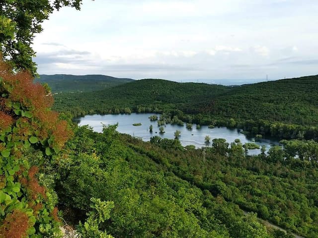
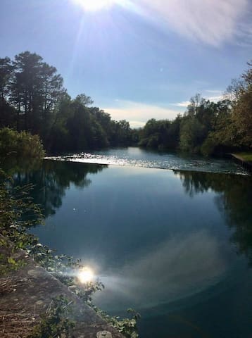
Lago di Doberdò
a 30 minuti d'auto potete raggiungere Doberdò del lago - Doberdob
La Riserva Naturale Regionale Laghi di Doberdò e Pietrarossa, istituita nel 1996, è un'area protetta friulana adagiata sul Carso goriziano in un territorio che si estende a cavallo dei comuni di Doberdò del Lago - Doberdob, Monfalcone e Ronchi dei Legionari.
Ciò che rende unica questa zona della regione è la presenza di due grandi depressioni carsiche occupate da due laghi separati da rilievi calcarei. La presenza di zone umide, praticamente assenti su tutto il Carso, ha consentito lo sviluppo di ambienti naturali rarissimi in questa area del Paese che è un piacere scoprire passeggiando lungo i sentieri si snodano sul territorio, attraverso habitat tipici degli ambienti aridi, come prati di landa e campi solcati, e delle zone umide che circondano i laghi.
I 4 trekking più affascinanti:
IL PERCORSO DELLA RISERVA
Occorrono circa 4 ore per completare questo itinerario impegnativo. Lungo il percorso si avrà l'opportunità di ammirare siti di interesse storico e naturalistico, come Casa Cadorna, e il cunicolo della prima guerra mondiale, attraverso il quale si raggiunge un magnifico punto panoramico che si affaccia sul lago. Tra folti pioppi, fresche acque argentee, lande cespugliate tipiche delle zone ripariali, e ripide pareti di roccia attrezzate per l'arrampicata, la passeggiata si rivela un'esperienza piacevole che permette di ottenere una visione a 360° dell'area protetta.
PERCORSO AD ANELLO BREVE
E' adatto a tutti il semplice itinerario che, in soli 30 minuti di cammino, permette di osservare le zone più interessanti della riserva. Si parte dal centro visite per poi proseguire verso la vecchia cava Solvay. Con lo sguardo si raggiunge facilmente la laguna di Grado e ci si può soffermare ad ammirare il punto di contatto tra il Carso e la pianura. Passeggiando nella fitta boscaglia, dapprima tra cespugli, pietrai e arbusti e poi tra carpini neri e ornielli, si gode dell'opportunità di scoprire una delle zone più rigogliose e affascinanti della riserva naturale.
PERCORSO AD ANELLO LUNGO
Ripercorrendo alcune delle tappe del Percorso della Riserva, quello ad Anello Lungo permette di visitare in un'ora e mezza alcuni dei siti più interessanti dell'area protetta, come la zona sorgentizia che emerge tra il folto dei pioppi, la cima del Colle Nero, raggiungibile attraverso una scalinata munita di corda di acciaio, l'antico castelliere, in cui si può anche entrare, e le baracche militari del primo conflitto mondiale disseminate lungo il sentiero.
PERCORSO FINO AL LAGO DI DOBERDO'
La passeggiata fino al lago è una sorta di versione ridotta del Percorso della Riserva, oltrepassata la cava di Solvay, il Colle Nero, Casa Cadorna e le pareti per l'arrampicata ed una volta raggiunta la zona sorgentizia e il sentiero che, in discesa, conduce al pontile panoramico, lo sguardo è immediatamente rapito dalla magnifica flora lacustre. Guardando con attenzione e, con un poco di fortuna, si potranno scorgere anche le graziose oche e le anatre in volo che popolano il bacino.
30 minutes by car you can reach Doberdò del lago - Doberdob
The Doberdò and Pietrarossa Lakes Regional Nature Reserve, established in 1996, is a Friuli protected area lying on the Gorizia Karst in a territory that straddles the municipalities of Doberdò del Lago - Doberdob, Monfalcone and Ronchi dei Legionari.
What makes this area of the region unique is the presence of two large karst depressions occupied by two lakes separated by limestone reliefs. The presence of wetlands, practically absent throughout the Karst, has allowed the development of very rare natural environments in this area of the country that is a pleasure to discover by walking along the paths that wind through the territory, through habitats typical of arid environments, such as meadows of moorland and furrowed fields, and the wetlands surrounding the lakes.
The 4 most fascinating treks:
THE PATH OF THE RESERVE
It takes about 4 hours to complete this challenging itinerary. Along the way you will have the opportunity to admire sites of historical and naturalistic interest, such as Casa Cadorna, and the tunnel of the First World War, through which you reach a magnificent panoramic point overlooking the lake. Among thick poplars, cool silvery waters, bushy moors typical of riparian areas, and steep rock walls equipped for climbing, the walk turns out to be a pleasant experience that allows you to get a 360 ° view of the protected area.
SHORT CIRCLE ROUTE
The simple itinerary is suitable for everyone which, in just 30 minutes of walking, allows you to observe the most interesting areas of the reserve. It starts from the visitor center and then continues towards the old Solvay quarry. With a glance you can easily reach the Grado lagoon and you can stop and admire the point of contact between the Karst and the plain. Walking through the dense bush, first among bushes, stone masons and shrubs and then among black hornbeams and ash trees, you will enjoy the opportunity to discover one of the most luxuriant and fascinating areas of the nature reserve.
LONG RING ROUTE
Retracing some of the stages of the Reserve Route, the Long Ring allows you to visit in an hour and a half some of the most interesting sites in the protected area, such as the spring area that emerges from the thicket of poplars, the top of Colle Nero, reachable via a staircase fitted with a steel rope, the ancient castle, which can also be entered, and the military barracks of the First World War scattered along the path.
ROUTE UNTIL LAKE DOBERDO '
The walk to the lake is a sort of shortened version of the Reserve Route, past the Solvay quarry, the Colle Nero, Casa Cadorna and the climbing walls and once you reach the spring area and the path that, downhill, leads to the panoramic pier, the gaze is immediately captivated by the magnificent lake flora. Looking carefully and, with a little luck, you will also be able to see the pretty geese and ducks in flight that populate the basin.
Slovenia
a 20 minuti d'auto da Sgonico- Zgonik raggiungete il paese Razdrto proprio sotto il monte Nanos, detto altopiano della bora (vento forte del Carso), per iniziare a piedi la salita del ripido sentiero che vi porta a 1.250 metri d'altitudine con uno splendido panorama.
A soli 20 minuti ci sono le grotte di Postumia e il castello di Predjama.
a 20-minute drive from Sgonico-Zgonik you reach the Razdrto village just below Mount Nanos, known as the Bora plateau (strong Karst wind), to start the climb on foot of the steep path that takes you to 1,250 meters above sea level with a splendid panorama.
Only 20 minutes away are the Postojna Caves and Predjama Castle.
6 recommandé par les habitants
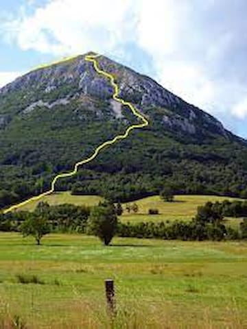
Nanos
a 20 minuti d'auto da Sgonico- Zgonik raggiungete il paese Razdrto proprio sotto il monte Nanos, detto altopiano della bora (vento forte del Carso), per iniziare a piedi la salita del ripido sentiero che vi porta a 1.250 metri d'altitudine con uno splendido panorama.
A soli 20 minuti ci sono le grotte di Postumia e il castello di Predjama.
a 20-minute drive from Sgonico-Zgonik you reach the Razdrto village just below Mount Nanos, known as the Bora plateau (strong Karst wind), to start the climb on foot of the steep path that takes you to 1,250 meters above sea level with a splendid panorama.
Only 20 minutes away are the Postojna Caves and Predjama Castle.
attraverso il confine di Gorjansko oppure Fernetti si raggiunge il paese Pliskovica vicino a Dutovlje. Il sentiero didattico è ideale per una breve passeggiata pianeggiante adatta anche ai bambini.
Nel cuore di Pliskovica ha inizio l’interessante percorso circolare segnato dalla pietra in cui è incisa una pecorella, simbolo di questo borgo carsico. Seguendo i vari segni, si arriva sulla tipica landa, per poi passare agli infiniti muri di pietra costruiti dagli abitanti locali, quando decisero di trasformare questo paesaggio roccioso in prati, pascoli e campi.
Grazie ai cartelli informativi, potrete scoprire le curiosità della landa carsica, conoscere gli uccelli locali e imparare qualcosa di più sugli stagni, sulla loro importanza nella storia passata e al giorno d’oggi. Il sentiero puramente didattico è ideale anche per chi desidera godersi una piacevole camminata nel tipico paesaggio del Carso.
through the border of Gorjansko or Fernetti you reach the village of Pliskovica near Dutovlje. The educational trail is ideal for a short flat walk also suitable for children.
In the heart of Pliskovica begins the interesting circular path marked by the stone in which a sheep is engraved, the symbol of this karst village. Following the various signs, you arrive on the typical moor, and then move on to the infinite stone walls built by the local inhabitants, when they decided to transform this rocky landscape into meadows, pastures and fields.
Thanks to the information signs, you will be able to discover the curiosities of the karst land, get to know the local birds and learn something more about the ponds, their importance in past history and today. The purely didactic path is also ideal for those who want to enjoy a pleasant walk in the typical Karst landscape.
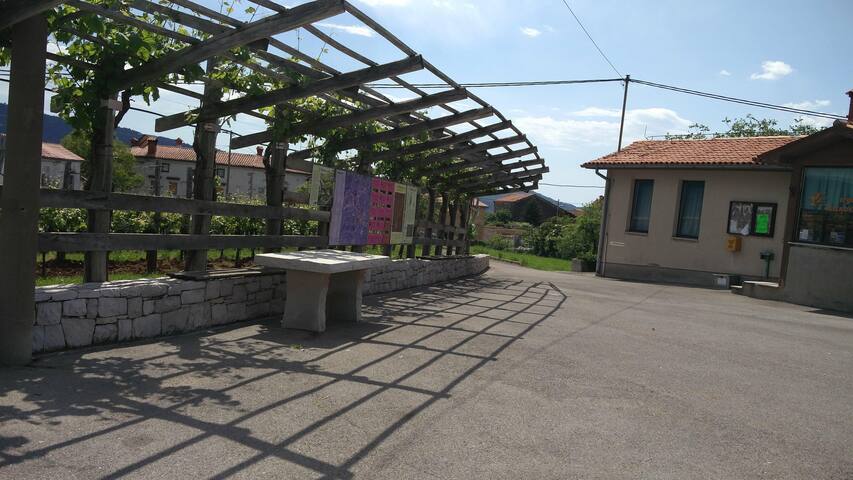
Pliskina pot
11 Pliskovicaattraverso il confine di Gorjansko oppure Fernetti si raggiunge il paese Pliskovica vicino a Dutovlje. Il sentiero didattico è ideale per una breve passeggiata pianeggiante adatta anche ai bambini.
Nel cuore di Pliskovica ha inizio l’interessante percorso circolare segnato dalla pietra in cui è incisa una pecorella, simbolo di questo borgo carsico. Seguendo i vari segni, si arriva sulla tipica landa, per poi passare agli infiniti muri di pietra costruiti dagli abitanti locali, quando decisero di trasformare questo paesaggio roccioso in prati, pascoli e campi.
Grazie ai cartelli informativi, potrete scoprire le curiosità della landa carsica, conoscere gli uccelli locali e imparare qualcosa di più sugli stagni, sulla loro importanza nella storia passata e al giorno d’oggi. Il sentiero puramente didattico è ideale anche per chi desidera godersi una piacevole camminata nel tipico paesaggio del Carso.
through the border of Gorjansko or Fernetti you reach the village of Pliskovica near Dutovlje. The educational trail is ideal for a short flat walk also suitable for children.
In the heart of Pliskovica begins the interesting circular path marked by the stone in which a sheep is engraved, the symbol of this karst village. Following the various signs, you arrive on the typical moor, and then move on to the infinite stone walls built by the local inhabitants, when they decided to transform this rocky landscape into meadows, pastures and fields.
Thanks to the information signs, you will be able to discover the curiosities of the karst land, get to know the local birds and learn something more about the ponds, their importance in past history and today. The purely didactic path is also ideal for those who want to enjoy a pleasant walk in the typical Karst landscape.
a soli 30 minuti d'auto da Sgonico - Zgonik potete visitare il parco delle Škocjanske jame per trekking, escursioni e corsa.
just 30 minutes by car from Sgonico - Zgonik you can visit the Škocjanske jame park for trekking, hiking and running
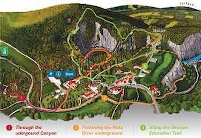
Regijski park Škocjanske jame
a soli 30 minuti d'auto da Sgonico - Zgonik potete visitare il parco delle Škocjanske jame per trekking, escursioni e corsa.
just 30 minutes by car from Sgonico - Zgonik you can visit the Škocjanske jame park for trekking, hiking and running
Vipavska dolina (vallata) per trascorrere una giornata tra passeggiate, corse, assaggiando i prodotti gastronomici della zona accompagnati dal buon vino a soli 30 minuti d'auto da Sgonico - Zgonik.
Da Ajdovščina si può raggiungere le foci del fiume Hubelj sia in auto che a piedi passeggiando per il sentiero vicino all'acqua, raggiungendo la trattoria Gostilna pri izviru Hublja (consigliato prenotare telefonicamente), dove si possono mangiare dei ottimi piatti gastronomici (idrijski žlikrofi, brodo di funghi, carne in vari modi, kuhani štruklji (struccoli cotti) con noci, ricotta o mirtilli e tant'altro.
Vipavska dolina (valley) to spend a day walking, running, tasting the gastronomic products of the area accompanied by good wine just 30 minutes by car from Sgonico - Zgonik.
From Ajdovščina you can reach the mouth of the Hubelj river either by car or on foot by walking along the path near the water, reaching the restaurant Gostilna pri izviru Hublja (recommended to book by phone), where you can eat excellent gastronomic dishes (idrijski žlikrofi, mushroom broth, meat in various ways, kuhani štruklji (cooked struccoli) with walnuts, cottage cheese or blueberries and much more.
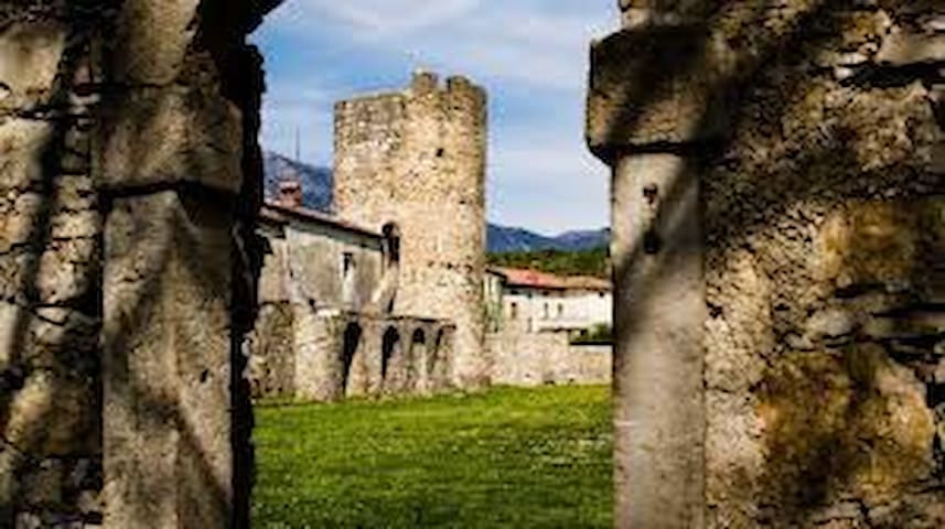
Vipava - Ajdovščina
Vipava - AjdovščinaVipavska dolina (vallata) per trascorrere una giornata tra passeggiate, corse, assaggiando i prodotti gastronomici della zona accompagnati dal buon vino a soli 30 minuti d'auto da Sgonico - Zgonik.
Da Ajdovščina si può raggiungere le foci del fiume Hubelj sia in auto che a piedi passeggiando per il sentiero vicino all'acqua, raggiungendo la trattoria Gostilna pri izviru Hublja (consigliato prenotare telefonicamente), dove si possono mangiare dei ottimi piatti gastronomici (idrijski žlikrofi, brodo di funghi, carne in vari modi, kuhani štruklji (struccoli cotti) con noci, ricotta o mirtilli e tant'altro.
Vipavska dolina (valley) to spend a day walking, running, tasting the gastronomic products of the area accompanied by good wine just 30 minutes by car from Sgonico - Zgonik.
From Ajdovščina you can reach the mouth of the Hubelj river either by car or on foot by walking along the path near the water, reaching the restaurant Gostilna pri izviru Hublja (recommended to book by phone), where you can eat excellent gastronomic dishes (idrijski žlikrofi, mushroom broth, meat in various ways, kuhani štruklji (cooked struccoli) with walnuts, cottage cheese or blueberries and much more.
a soli 35 minuti d'auto vicino a a Kostanjevica potete godervi una passeggiata nella natura carsica, con un panorama meraviglioso, rifocillandovi in cima al rifugio Stjenka.
Anche i sentieri vicini sono ideali per chi pratica mountain bike.
only 35 minutes by car near Kostanjevica you can enjoy a walk in the karst nature, with a wonderful panorama, refreshing yourself at the top of the Stjenka hut.
The nearby trails are also ideal for mountain bikers.
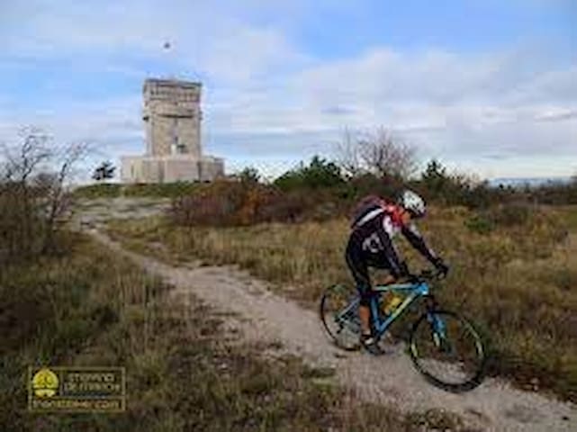
Trstelj
a soli 35 minuti d'auto vicino a a Kostanjevica potete godervi una passeggiata nella natura carsica, con un panorama meraviglioso, rifocillandovi in cima al rifugio Stjenka.
Anche i sentieri vicini sono ideali per chi pratica mountain bike.
only 35 minutes by car near Kostanjevica you can enjoy a walk in the karst nature, with a wonderful panorama, refreshing yourself at the top of the Stjenka hut.
The nearby trails are also ideal for mountain bikers.
a soli 35 minuti d'auto potete godervi la cima alta 1.027 metri, alla quale potete accedere da più direzioni: tuttavia, la più amata è quella del sentiero Magajna, che inizia nella Valle di Vreme. La catena stupisce gli escursionisti grazie ai suoi infiniti pendii pianeggianti, cosparsi di prati fiorenti in estate e su cui pascolano innumerevoli esemplari di pecore. Raggiungendo la sommità di Vremščica, rimarrete esterrefatti dalle vedute che vi circondano, ammirando il Mar Adriatico, le Dolomiti e le Alpi Giulie oppure i colli Brkini e la Čičarija. Qui potrete fare una sosta e visitare la chiesa ristrutturata di San Urbano, passeggiare tra i pascoli e scoprire la ricca biodiversità carsica e, infine, fare ritorno al punto di partenza.
just 35 minutes by car you can enjoy the 1,027 meter high peak, which you can access from several directions: however, the most popular is that of the Magajna trail, which starts in the Vreme Valley. The range amazes hikers with its endless flat slopes, sprinkled with flourishing meadows in summer and on which countless sheep graze. Reaching the top of Vremščica, you will be amazed by the views that surround you, admiring the Adriatic Sea, the Dolomites and the Julian Alps or the Brkini and Čičarija hills. Here you can stop and visit the restored church of San Urbano, stroll through the pastures and discover the rich karst biodiversity and, finally, return to the starting point.
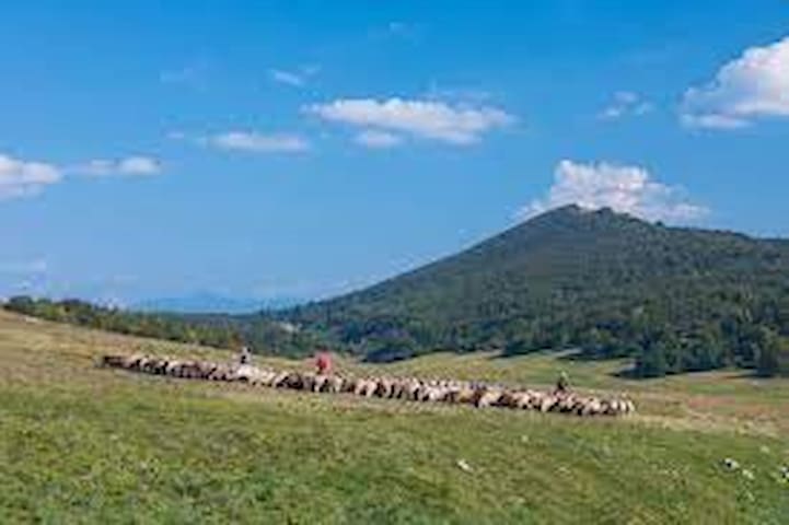
Vremščica
a soli 35 minuti d'auto potete godervi la cima alta 1.027 metri, alla quale potete accedere da più direzioni: tuttavia, la più amata è quella del sentiero Magajna, che inizia nella Valle di Vreme. La catena stupisce gli escursionisti grazie ai suoi infiniti pendii pianeggianti, cosparsi di prati fiorenti in estate e su cui pascolano innumerevoli esemplari di pecore. Raggiungendo la sommità di Vremščica, rimarrete esterrefatti dalle vedute che vi circondano, ammirando il Mar Adriatico, le Dolomiti e le Alpi Giulie oppure i colli Brkini e la Čičarija. Qui potrete fare una sosta e visitare la chiesa ristrutturata di San Urbano, passeggiare tra i pascoli e scoprire la ricca biodiversità carsica e, infine, fare ritorno al punto di partenza.
just 35 minutes by car you can enjoy the 1,027 meter high peak, which you can access from several directions: however, the most popular is that of the Magajna trail, which starts in the Vreme Valley. The range amazes hikers with its endless flat slopes, sprinkled with flourishing meadows in summer and on which countless sheep graze. Reaching the top of Vremščica, you will be amazed by the views that surround you, admiring the Adriatic Sea, the Dolomites and the Julian Alps or the Brkini and Čičarija hills. Here you can stop and visit the restored church of San Urbano, stroll through the pastures and discover the rich karst biodiversity and, finally, return to the starting point.
a 50 minuti d'auto da Sgonico - Zgonik, ideale per trekking o mountain bike il monte Slavnik con i suoi 1028 metri, è il più alto dell’Istria slovena. Dalla cima si gode di un panorama a dir poco favoloso sul Golfo di Trieste, le Alpi Carniche e Giulie, le Caravanche e le Alpi di Kamnik, l’Istria croata e le montagne di Gorski Kotar, la valle del Vipava e il monte Nanos. Potete rifocilarvi al rifugio Tumova koča na Salvniku.
50 minutes by car from Sgonico - Zgonik, ideal for trekking or mountain biking, Mount Slavnik with its 1028 meters, is the highest in Slovenian Istria. From the top you can enjoy a fabulous view of the Gulf of Trieste, the Carnic and Julian Alps, the Karawanken and Kamnik Alps, Croatian Istria and the mountains of Gorski Kotar, the Vipava valley and Mount Nanos, to say the least. You can refresh yourself at the Tumova koča na Salvniku refuge.
8 recommandé par les habitants
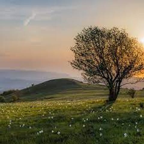
Slavnik
a 50 minuti d'auto da Sgonico - Zgonik, ideale per trekking o mountain bike il monte Slavnik con i suoi 1028 metri, è il più alto dell’Istria slovena. Dalla cima si gode di un panorama a dir poco favoloso sul Golfo di Trieste, le Alpi Carniche e Giulie, le Caravanche e le Alpi di Kamnik, l’Istria croata e le montagne di Gorski Kotar, la valle del Vipava e il monte Nanos. Potete rifocilarvi al rifugio Tumova koča na Salvniku.
50 minutes by car from Sgonico - Zgonik, ideal for trekking or mountain biking, Mount Slavnik with its 1028 meters, is the highest in Slovenian Istria. From the top you can enjoy a fabulous view of the Gulf of Trieste, the Carnic and Julian Alps, the Karawanken and Kamnik Alps, Croatian Istria and the mountains of Gorski Kotar, the Vipava valley and Mount Nanos, to say the least. You can refresh yourself at the Tumova koča na Salvniku refuge.
a più di un ora d'auto da Sgonico - Zgonik trovate il monte Snežnik (Nevoso) è la cima più alta del carso sloveno. Dalle sue tre cime, coperte di neve fino a primavera inoltrata, si apre un’incredibile vista su gran parte della Slovenia, sull’Istria, sul Quarnero e sul Golfo di Trieste.
Grazie alla ricca vegetazione e alle sue bellezze naturali è stato dichiarato riserva botanica.
Vari sentieri conducono in vetta, il più famoso è pero quello che parte da Sviščaki.
In cima ci sono la baita Draga Karolina e un rifugio, dove i visitatori possono rinfrescarsi e riposare prima della discesa a valle.
more than an hour's drive from Sgonico - Zgonik you will find Mount Snežnik (Snowy) is the highest peak in the Slovenian Karst. From its three peaks, covered with snow until late spring, an incredible view opens up over much of Slovenia, Istria, Kvarner and the Gulf of Trieste.
Thanks to the rich vegetation and its natural beauties it has been declared a botanical reserve.
Various trails lead to the summit, the most famous being the one starting from Sviščaki.
At the top are the Draga Karolina hut and a refuge, where visitors can cool off and rest before descending to the valley.
11 recommandé par les habitants
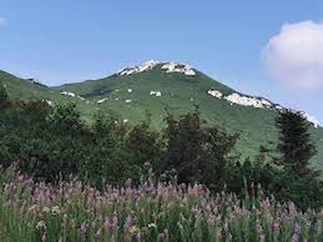
Snežnik
a più di un ora d'auto da Sgonico - Zgonik trovate il monte Snežnik (Nevoso) è la cima più alta del carso sloveno. Dalle sue tre cime, coperte di neve fino a primavera inoltrata, si apre un’incredibile vista su gran parte della Slovenia, sull’Istria, sul Quarnero e sul Golfo di Trieste.
Grazie alla ricca vegetazione e alle sue bellezze naturali è stato dichiarato riserva botanica.
Vari sentieri conducono in vetta, il più famoso è pero quello che parte da Sviščaki.
In cima ci sono la baita Draga Karolina e un rifugio, dove i visitatori possono rinfrescarsi e riposare prima della discesa a valle.
more than an hour's drive from Sgonico - Zgonik you will find Mount Snežnik (Snowy) is the highest peak in the Slovenian Karst. From its three peaks, covered with snow until late spring, an incredible view opens up over much of Slovenia, Istria, Kvarner and the Gulf of Trieste.
Thanks to the rich vegetation and its natural beauties it has been declared a botanical reserve.
Various trails lead to the summit, the most famous being the one starting from Sviščaki.
At the top are the Draga Karolina hut and a refuge, where visitors can cool off and rest before descending to the valley.
Visite turistiche
a Sistiana verso la strada per il mare e vicino al sentiero Rilke, per richiedere la carta FVG on line o ritirare dei deplian https://www.turismofvg.it/Offerte/FVG-Card
in Sistiana towards the road to the sea and near the Rilke path,to request the FVG card online or to collect brochures
PromoTurismoFVG InfoPoint di Sistiana
a Sistiana verso la strada per il mare e vicino al sentiero Rilke, per richiedere la carta FVG on line o ritirare dei deplian https://www.turismofvg.it/Offerte/FVG-Card
in Sistiana towards the road to the sea and near the Rilke path,to request the FVG card online or to collect brochures
sul Carso triestino nella provincia di Trieste trovate nei paesi dei suggerimenti di viaggio e le descrizioni delle particolarità del territorio
on the Trieste Karst in the province of Trieste you will find travel tips and descriptions of the particularities of the area in the villages
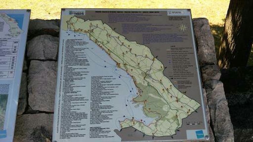
Tra mare e Carso Provincia di Trieste - Z morja na Kras Pokrajina Trst
sul Carso triestino nella provincia di Trieste trovate nei paesi dei suggerimenti di viaggio e le descrizioni delle particolarità del territorio
on the Trieste Karst in the province of Trieste you will find travel tips and descriptions of the particularities of the area in the villages